
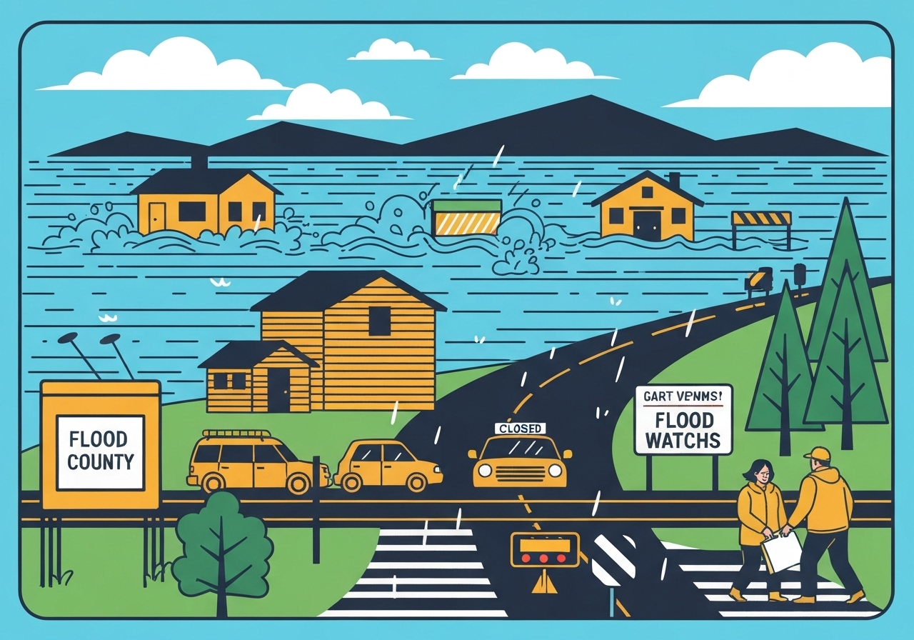
— Heavy December rain from an atmospheric river pushed the Clackamas and Sandy rivers above their banks on Friday, flooding homes and prompting widespread flood watches across northwest Oregon and southwest Washington. Authorities issued evacuation notices for low-lying areas along the Clackamas River, while thousands of customers faced power outages and major highways reported lane or full closures. The National Weather Service warned river rises could continue into Saturday afternoon even as rainfall tapers, and mountain passes carried winter storm advisories with up to a foot of snow. Local residents described scenes of water lapping at garage doors and bedroom windows in the Carver Mobile Home Ranch near Damascus.
Key Takeaways
- Heavy rain fell on Dec. 19, 2025, with many locations in the Clackamas basin recording 3–4 inches or more in 24 hours, accelerating river rises.
- Evacuation notices are active for low-lying areas from Interstate 205 out to Milo McIver State Park; those zones are classified Level 2 (be set to evacuate).
- Flood watches remain in effect across large swaths of northwest Oregon and southwest Washington through Saturday afternoon per the National Weather Service.
- Major road impacts include lane or full closures on U.S. 101, Oregon 6 and other routes feeding the Willamette Valley; U.S. 20 has also seen disruptions.
- Utilities reported outages: Portland General Electric showed more than 6,000 customers affected early Friday, and Pacific Power logged over 3,000 outages.
- Mountain passes in the Cascades carry winter advisories with up to 12 inches of snow expected in some locations, complicating holiday travel.
- The Cowlitz River near Kelso, Washington, is still rising, raising cross-border concerns for Southwest Washington communities.
Background
Northern Oregon and southwest Washington are in the path of a strong atmospheric river that delivered prolonged, heavy rainfall beginning earlier in the week and peaking on Dec. 19. Atmospheric rivers—narrow corridors of enhanced moisture transport from the Pacific—often produce intense precipitation over hours to days, leading to saturated soils and rapid runoff into river systems. The region’s soils were already wet from prior storms, reducing the landscape’s ability to absorb additional precipitation and accelerating streamflow. Infrastructure in low-lying corridors along the Sandy and Clackamas rivers has a history of flood vulnerability, prompting pre-established evacuation zones and monitoring protocols run by county emergency managers and the National Weather Service.
Clackamas County and adjacent jurisdictions have contingency plans that escalate with river forecasts; Level 2 advisories are intended to give residents time to prepare and relocate if waters rise further. Transport arteries linking coastal and valley communities—such as U.S. 101 and Oregon 6—are particularly sensitive to runoff and debris flows during heavy rain events. Winter travel is further complicated when the same storm produces heavy snow at higher elevations, which can close passes and delay emergency response. Utility networks are also vulnerable: fallen trees from saturated soils and high winds commonly cause outages that can affect thousands of customers during multi-hazard events.
Main Event
On Friday morning, floodwaters moved through the Carver Mobile Home Ranch in Clackamas County, leaving several residences partially submerged and pushing water up to garage doors and bedroom windows. Photographs and on-scene descriptions indicated widespread standing water in that park and other low-lying neighborhoods southeast of Portland. County officials placed thousands of residents under evacuation notices; emergency managers focused immediate attention on less populated reaches of the Clackamas basin where rapid rises were forecasted.
National Weather Service meteorologist Sebastian Westerink told reporters that many sites in the Clackamas watershed received three to four inches of rain in the previous 24 hours, with even higher totals reported southeast of Estacada—contributions that drove the rapid river response. Forecasters emphasized that while rainfall rates were expected to ease on Friday, cumulative runoff and slow-responding rivers could keep flood risk elevated into Saturday afternoon. The Sandy River near Bull Run and stretches of the Clackamas remain highlighted for concern, and Sandy River flooding could also affect portions of east Multnomah County near Troutdale.
Road authorities reported closures and lane restrictions on several routes: coastal sections of U.S. 101 and Oregon 6 experienced operational impacts, and key connectors into the Willamette Valley, including U.S. 20, saw disruptions from debris and standing water. Winter weather advisories were active over Cascade passes, where forecasts called for up to a foot of snow in some corridors, creating a compound hazard for travelers returning for the holidays. Power utilities confirmed thousands of outages across the region early Friday—over 6,000 customers with Portland General Electric and more than 3,000 with Pacific Power—complicating local response and recovery efforts.
Analysis & Implications
This event illustrates how atmospheric rivers can produce multi-faceted hazards: coastal and lowland flooding, debris-covered roadways, and heavy mountain snow. The immediate priority is life-safety—evacuations, road closures, and utility restorations—but the broader implications extend to infrastructure stress and economic disruption during the holiday period. Flooding in manufactured home parks and other vulnerable neighborhoods tends to produce disproportionate displacement and recovery needs, especially for households with limited mobility or resources to relocate quickly.
From a hydrologic perspective, saturated soils and antecedent moisture meant that even moderate additional rainfall produced outsized runoff. That dynamic is why forecasters stressed that decreasing hourly rain rates do not equate to instantaneous relief: many small to medium rivers respond more slowly, and their peaks can lag precipitation by many hours or even into the next day. Emergency managers must therefore plan for prolonged inundation and delayed road reopenings, and communities should expect the need for sandbagging, search and rescue, and temporary shelters in the near term.
Economically, highway closures on U.S. 101, Oregon 6 and U.S. 20 disrupt freight and commuter flows, increasing delivery times and potentially stranding travelers. Utility outages affect heating and communications in cold weather conditions—heightening public health risks for the elderly and medically vulnerable. On a municipal level, repair costs for washed-out local roads, culverts and debris-clearing can strain winter maintenance budgets and delay other planned projects.
Comparison & Data
| River / Location | 24‑hr Rain (approx.) | Evacuation / Status | Notes |
|---|---|---|---|
| Clackamas River (Carver area) | 3–4 inches (higher SE of Estacada) | Level 2 advisories from I‑205 to Milo McIver | Homes partially submerged; active evacuations |
| Sandy River (near Bull Run) | Similar 24‑hr totals in upstream areas | Areas of concern in less populated reaches | Possible impacts downstream toward Troutdale |
| Cowlitz River (near Kelso, WA) | Ongoing rises | Monitoring by WA authorities | Cross‑state flood risk |
The table above summarizes observed rainfall and operational responses on Dec. 19, 2025. These numbers reflect reported 24‑hour totals and official evacuation classifications; they do not represent final damage assessments. River responses vary by basin geometry and land use, so localized impacts may differ from watershed averages. Emergency and transportation agencies are updating status information through the day as crews assess roads and clear hazards.
Reactions & Quotes
National Weather Service briefings framed the event as a classic rapid-response flooding episode driven by concentrated rainfall over wet soils.
“Those amounts are certainly contributing to the rapid rise of the river.”
Sebastian Westerink, National Weather Service — Portland office
Local residents expressed shock and concern as familiar river levels exceeded historical marks in some neighborhoods. One long-time resident described checking on neighbors and noting water higher than he’d ever seen.
“I feel tragic for the people that are dealing with it… They are under dire need right now to keep themselves safe.”
Curtis Gillette, Damascus resident
Utilities and road crews emphasized ongoing response and prioritized safety while working to restore services and reopen corridors.
“Many rivers and streams are still expected to rise… slow responding rivers could see rises into Saturday afternoon.”
National Weather Service — flood forecast statement
Unconfirmed
- Exact counts of homes with significant structural damage remain preliminary and have not been verified by county damage assessments.
- Timetables for full restoration of power and reopening all affected highways are not confirmed; utility and transportation agencies are still evaluating conditions.
- Reports of localized mudslides or road washouts in secondary roads are being collected but not yet independently confirmed by emergency crews.
Bottom Line
Flooding on Dec. 19, 2025, driven by an atmospheric river, has produced significant localized inundation along the Clackamas and Sandy rivers, forced evacuations and disrupted transportation and power services across northwest Oregon and southwest Washington. Even as rainfall rates fall, hydrologic momentum means rivers may continue rising into Saturday, so residents in designated evacuation zones should heed county guidance and be ready to move quickly.
Travelers should avoid nonessential trips, check official state traffic cameras and the National Weather Service before departing, and expect aftereffects—power restoration, road repairs and cleanup—to take days in the hardest-hit areas. Local emergency managers will post updates as assessments conclude; residents should rely on official channels listed below for real-time instructions.
Sources
- Oregon Public Broadcasting (local journalism) — original reporting and scene coverage.
- National Weather Service — Portland office (official forecasts) — flood watches, river forecasts and meteorologist statements.
- Portland General Electric (utility) — outage maps and customer impact reports.
- Pacific Power (utility) — outage maps and restoration updates.