
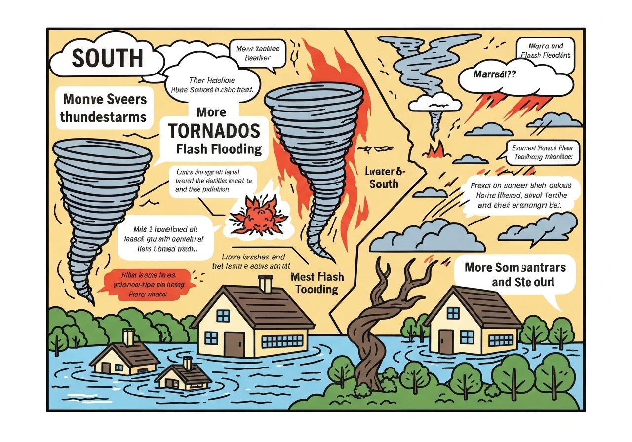
Lead — A potent storm system on January 10, 2026, threatens the Deep South with severe thunderstorms, possible tornadoes and flash flooding from Saturday morning into the evening. A Flash Flood Watch covers more than 8 million people across parts of Alabama and Georgia through Saturday evening. Early activity was concentrated over Mississippi, and forecasters say the greatest threat window is morning into afternoon when conditions favor severe development. Rain and embedded storms will push east and northeast overnight, carrying the risk into the Mid-Atlantic and parts of the Northeast.
Key Takeaways
- Flash Flood Watch in effect for more than 8 million people in parts of Alabama and Georgia until Saturday evening.
- Multiple tornadoes have already occurred this week; the system on Jan. 10 may produce additional tornadoes, damaging winds and some large hail.
- Storms will move along a corridor from New Orleans to Clemson, South Carolina, impacting cities including Atlanta and Pensacola.
- Forecast additional rainfall totals across the South are generally 1–3 inches, with localized 3–4 inches possible in portions of Mississippi, Alabama and Tennessee.
- Rain is expected to arrive in Philadelphia near 11 a.m., New York City after 12 p.m., and Boston later in the afternoon, shifting the wet threat up the East Coast into the evening and overnight.
- On the storm’s northern flank, light snow (a quick dusting to 3 inches) is possible in Chicago Saturday morning, with 3–6 inches in parts of Wisconsin and Michigan; northern New England could see up to a 3-inch dusting and near a tenth of an inch of ice.
Background
The region faces heightened risk because a strong upper-level trough and amplified jet stream are drawing warm, moist air north from the Gulf of Mexico into an unstable atmosphere. That classic winter severe-weather setup has produced tornadoes and flash flooding earlier in the week, including damage documented in Purcell, Oklahoma, on Jan. 8, 2026. With the low-pressure system progressing east, forecasters expected renewed convective activity across the Deep South on Saturday.
Seasonal severe outbreaks are not unprecedented in the South: the combination of Gulf moisture, wind shear and daytime heating frequently produces organized thunderstorms in winter and spring. State and local emergency managers, along with the National Weather Service, have issued watches and advisories to give residents time to prepare. Utilities and transportation agencies monitor the threat because damaging winds and floodwaters can cause outages and travel disruptions.
Main Event
Early Saturday, storm clusters were active over parts of Mississippi and were expected to intensify as the day warmed. Forecasters said the most favorable conditions for tornado development would be from the morning into the afternoon hours, when increasing instability and vertical wind shear may support rotating thunderstorms. Damaging wind, tornadoes and isolated large hail were described as the primary severe hazards during the core threat window.
A Flash Flood Watch remained in effect for much of Alabama and Georgia through Saturday evening, reflecting the risk of multiple rounds of heavy rain. Models and observations pointed to a widespread additional 1 to 3 inches of rain across the South, with localized pockets receiving 3 to 4 inches—enough to produce rapid runoff in urban and low-lying areas. The severe threat was forecast to diminish later in the afternoon into early evening, but rain was expected to continue pushing east and northeast through the late evening and overnight hours.
The precipitation shield extended from the Gulf Coast toward the Carolinas, with cities from New Orleans to Clemson—including Atlanta and Pensacola—on the advisory map. On the storm’s northern side, temperatures and dynamics allowed a wintry mix: Chicago could see a brief dusting up to 3 inches Saturday morning ahead of clearer skies for an NFL Wild Card matchup in the evening, while parts of Wisconsin and Michigan faced 3 to 6 inches of snowfall and northern New England remained cold enough for a light accumulation and minor icing.
Analysis & Implications
The immediate public-safety concern is flash flooding in urban corridors and river basins where 1–4 inches of additional rain can produce rapid rises and overwhelmed storm drains. Cities such as Birmingham and Atlanta have extensive impervious cover, which accelerates runoff; even short-duration heavy rainfall can strand vehicles and inundate underpasses. Emergency managers typically emphasize “Turn Around, Don’t Drown” messaging because hidden currents and stalled vehicles are frequent sources of fatalities in flash floods.
For tornado and damaging-wind risk, the storm’s environment—strong low-level shear and ample moisture—favored supercell or quasi-linear convective modes capable of producing localized tornadoes and widespread wind damage. Power outages could occur where trees fall onto lines, and downed debris may hamper road clearance and emergency responses. Utilities often pre-position crews and issue safety advisories ahead of such systems to speed restoration when outages occur.
Economically, the event’s short-term impacts include flight delays and cancellations in the Southeast and Mid-Atlantic, hazardous road conditions affecting commerce and potential agricultural stress in exposed areas. If heavier localized flooding hits critical infrastructure—pump stations or water-treatment facilities—the public-health consequences could extend beyond the immediate storm. Recovery costs depend on the spatial concentration of damage; a few localized severe tornadoes or flash-flood hotspots can drive disproportionate repair bills.
Comparison & Data
| Region | Expected Precip / Snow | Primary Hazard |
|---|---|---|
| Deep South (AL, MS, GA) | 1–3 inches typical; localized 3–4 inches | Flash flooding, tornadoes, damaging wind |
| Gulf Coast to Carolinas | Scattered heavy storms through afternoon | Damaging wind, isolated tornadoes |
| Northeast (I‑95 corridor) | Rain moving in mid/late day (Phila 11 a.m., NYC after 12 p.m.) | Travel delays, flooding in urban areas |
| Upper Midwest / Great Lakes | 3–6 inches possible in MI/WI; Chicago dusting to 3 inches | Snow impacts on roads, brief travel disruption |
These ranges reflect forecast guidance in place on Jan. 10, 2026. The largest rainfall totals are likely where storms train—i.e., multiple cells cross the same area—so localized flash flooding can exceed the listed typical amounts. Snow totals on the storm’s cold sector depend on the strength of the northern pull and thermal profiles near the surface; small shifts in the track change amounts markedly for cities near the rain–snow transition.
Reactions & Quotes
National and local weather authorities emphasized preparedness as storms moved in. Officials urged residents in watch areas to have a plan, monitor updates and avoid travel in flooded or storm‑damaged corridors. The following statements were released or summarized by official offices and local officials as the system evolved.
Context before quote: The National Weather Service issued watches and warnings to highlight the combined flood and severe threat across the Deep South, and stressed that conditions this morning into the afternoon favored rapid storm intensification. Forecasters called for heightened vigilance in communities near rivers and in urban neighborhoods where drainage is limited. The NWS also highlighted the potential for multiple rounds of heavy rain into the overnight period as the system pushes east.
“Conditions will be favorable for severe development this morning into the afternoon; follow local watches and warnings and be prepared to take shelter if warned.”
National Weather Service (official advisory)
Context after quote: The advisory underscored that watches are not guarantees of impact but a prompt to prepare and monitor evolving conditions. Emergency managers typically use these windows to ready response teams and communicate evacuation or shelter options where necessary. The NWS continues to issue spot forecasts and updates as observations arrive.
Context before quote: Local emergency management offices in affected counties reminded residents that flash flooding develops quickly and that roads become impassable within minutes of heavy rainfall. Officials encouraged nonessential travel to be postponed in watch areas and warned drivers not to attempt crossing standing water. They noted that response crews focus first on life‑safety calls before property recovery.
“Avoid flooded roadways and move to higher ground if water begins to rise near your home; do not drive through standing water.”
Local Emergency Management (public safety advisory)
Context after quote: That guidance reflects a standard flood-safety protocol; local agencies often stage rescue and road-closure teams when watches escalate to warnings. Communities with recent antecedent rainfall or saturated soils are at higher risk for quick runoff and localized street flooding. Officials urged residents to secure outdoor items and keep phones charged for alerts.
Context before quote: Meteorologists commenting on the setup noted the confluence of strong shear and Gulf moisture increases the likelihood of rotating storms, which can produce brief but intense tornadoes. They also highlighted that banded heavy rainfall can lead to fast urban flooding even in areas not typically prone to tornadoes. Weather analysts cautioned that small changes in storm track and timing materially affect local outcomes.
“The atmospheric setup favors rotating storms and heavy rainfall; the main window for severe threats is the morning into the afternoon period.”
Regional Meteorologist (analysis)
Context after quote: Analysts said residents should monitor real-time radar and official warnings rather than relying on scheduled forecasts alone because mesoscale changes control where the worst impacts fall. Media and emergency services often relay rapid updates as watches change to warnings in counties with detected rotation or flash flooding. Communities should expect intermittent updates through the evening as the system progresses eastward.
Unconfirmed
- The precise number and intensity ratings of tornadoes that may occur during the Jan. 10 outbreak remain pending on post‑event surveys.
- Preliminary local rainfall reports of 3–4 inches in some pockets are subject to revision as gauge and radar-adjusted totals are finalized.
- Full scope of power outages and infrastructure damage across affected counties is not yet verified and will be assessed after the event.
Bottom Line
Residents across the Deep South should treat Saturday morning into afternoon as the highest-risk period for tornadoes, damaging wind and flash flooding, especially in parts of Alabama, Mississippi and Georgia under the Flash Flood Watch. Keep emergency supplies accessible, avoid travel in heavy rain, and heed local officials and National Weather Service warnings. Expect storm impacts to shift eastward into the evening and overnight, bringing heavy rain to the Mid-Atlantic and coastal Northeast, while the northern flank may see wintry precipitation in parts of the Upper Midwest and New England.
Short-term preparedness—planning safe shelter, avoiding flooded roads and monitoring local forecasts—reduces risk when storms intensify quickly. After the storms pass, officials will consolidate damage assessments and update warnings; those with property in flood-prone corridors should document conditions safely and contact local emergency management for recovery resources. Continued attention to official sources will be essential as the situation evolves through Saturday night.