
Lead: More than 200 million people across the United States are bracing for a major winter storm set to intensify over the weekend, with the National Weather Service updating maps and warnings on Jan. 22, 2026. The system is forecast to start in the southern Plains on Friday and move eastward through the South into the East Coast, threatening heavy snow, widespread ice and extreme cold across roughly 35 states. Forecasts indicate about 175 million people are under winter weather or extreme cold alerts and about 160 million are under alerts for snow, sleet or freezing rain, raising the risk of life‑threatening conditions. Officials warn travel disruptions, power outages and record low temperatures in parts of the southern Plains and mid‑Atlantic could follow.
Key takeaways
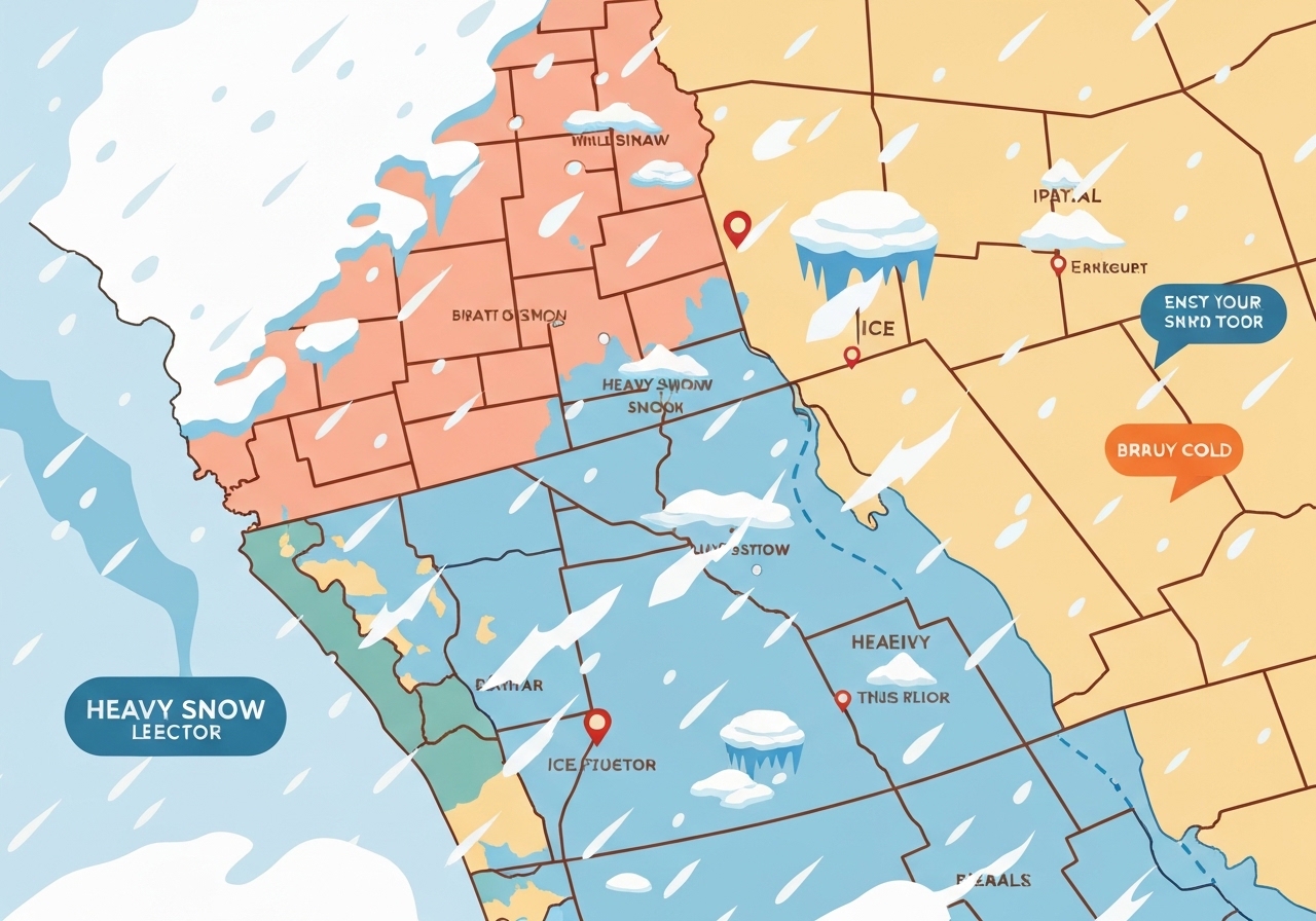
- More than 200 million people nationwide are in the potential impact area of the weekend storm, covering a roughly 2,000‑mile swath from the Rockies to the East Coast.
- About 175 million are under winter weather or extreme cold alerts, and roughly 160 million are under alerts for snow, sleet or freezing rain, per the National Weather Service.
- Heavy snow could reach a foot or more in places such as the Texas Panhandle and the Ozarks, with localized totals possibly reaching 2 feet in the central Appalachians and parts of the Northeast.
- Ice accumulations are expected along the storm’s southern track, typically between 0.2 and 0.5 inches, enough to down power lines and cause outages in vulnerable areas.
- Southern Plains totals of 5–10 inches of snow are possible as the system develops Friday into Saturday; exact amounts remain sensitive to small temperature shifts.
- Wind chill values may feel like 40°F to 50°F below zero in parts of the northern U.S., and frostbite can occur in 5–10 minutes in exposed skin at such extremes.
- Major airports in the South—Dallas/Fort Worth, Oklahoma City, Little Rock, Memphis, Nashville and Atlanta—are at risk for cancellations due to limited deicing resources at some facilities.
- Officials advise avoiding travel through the weekend; emergency kits and preparations are strongly recommended for people in affected areas.
Background
The storm is driven by a low‑pressure system forming in the Southwest that will interact with Gulf moisture and an outbreak of Arctic air. Meteorologists at the Weather Prediction Center and the National Weather Service say that combination has produced a broad, slow‑moving system capable of delivering multiple precipitation types — snow, sleet, freezing rain — across a large area. This setup also coincides with a southward dip of the polar vortex into the eastern half of the U.S., which amplifies the cold air mass and increases the chance of record low temperatures in some regions.
Past events illustrate the stakes: 2021’s deep freeze in Texas caused prolonged outages and multiple fatalities after infrastructure and grid systems were overwhelmed. States across the South have limited winter‑operational assets — some smaller airports lack deicing equipment and many road crews have limited experience with widespread icing events — leaving communities more vulnerable than in northern states. Officials from state emergency management offices and grid operators are coordinating pre‑staging resources and issuing guidance to residents ahead of the storm.
Main event
Forecast models indicate precipitation will begin in the southern Plains on Friday, with the main swath of wintry weather moving east through the weekend. As the system progresses, forecasters expect heavy snow bands to set up across the central Plains into the Midwest and a separate axis of high totals in the central Appalachians and Northeast. In the southern sector, a narrow zone of freezing rain and sleet is likely on the southern fringe of the storm track where surface temperatures remain near freezing.
Ice accumulation is forecast to range typically from two‑tenths to one‑half inch along that southern band; meteorologists warn that even those modest amounts can snap tree limbs and down distribution lines, especially when combined with heavy, wet snow. A slow storm motion increases the risk of prolonged impacts — roads can remain icy for extended periods and falling trees may block power restoration efforts. National Weather Service meteorologists Rich Otto and Tony Fracasso have stressed that small temperature changes of one to two degrees can shift a location from snow to sleet or freezing rain, producing sharp contrasts in local impacts.
Air travel disruptions are likely at several southern hubs that may not be equipped for widespread deicing needs; carriers have issued waivers and travelers should expect cancellations and delays. Major interstates across the South and central U.S.—including I‑10, I‑20, I‑30, I‑35, I‑40, I‑44, I‑49 and I‑55—are at risk for treacherous conditions, and officials are strongly discouraging nonessential travel through the weekend. Emergency personnel and hospitals in cold‑expectant cities are standing by to treat frostbite, hypothermia and storm‑related injuries.
Analysis & implications
The combined threat of heavy snow, accumulating ice and a very cold air mass raises cascading risks: transportation networks can be paralyzed, power infrastructure can be stressed or fail, and vulnerable populations may face life‑threatening exposure. In regions with aging distribution lines or limited tree clearance, an ice accumulation of a few tenths of an inch can trigger widespread outages; when temperatures remain far below freezing, restoring heat becomes both urgent and logistically harder.
Economic disruptions are likely to be concentrated in travel, logistics and energy sectors. Airport closures and highway stoppages will delay freight movements and just‑in‑time deliveries, adding short‑term stress to supply chains. Power demand typically spikes as space heating needs rise; grid operators in Texas and elsewhere are emphasizing preparedness after the 2021 event, but prolonged outages in colder conditions could still produce severe public‑safety consequences.
Public‑health systems will also be tested. Emergency rooms and shelters can expect higher volumes of cold‑related injuries and illnesses, particularly among older adults, the unhoused and those with limited home heating. Local officials may open warming centers and activate mutual‑aid agreements to move fuel trucks and crews into hard‑hit areas, but access challenges on icy roads could delay those efforts. At the geopolitical level, the storm is a domestic infrastructure and resilience story rather than an international issue, but its scale underscores how climate variability and atmospheric dynamics can produce extreme winter events in a warming world.
Comparison & data
| Metric | Reported value | Notes |
|---|---|---|
| People in storm impact area | More than 200 million | Roughly two‑thirds of the U.S. may be affected |
| Winter weather / extreme cold alerts | ~175 million | National Weather Service statistics, Jan. 22, 2026 |
| Snow/sleet/freezing rain alerts | ~160 million | Wide swath from Arizona to Maine |
| Peak snowfall | Up to 24 inches | Central Appalachians and parts of the Northeast (localized) |
| Ice accumulation | 0.2–0.5 in | Southern side of storm track; can down lines |
| Wind chill | −40°F to −50°F (feels like) | Northern U.S. locations at highest risk |
The table above synthesizes publicly reported figures from the National Weather Service and meteorologists tracking the system. While aggregate population counts and ranges are robust, localized totals and timing remain sensitive to model shifts; small temperature differences will determine precipitation type and exact snowfall amounts. Emergency planners typically use the upper ends of these ranges to stage resources, but responders also note that a slow storm increases exposure time and complicates clearing and restoration operations.
Reactions & quotes
Officials and medical personnel have begun urging residents to prepare and limit travel. Grid and state officials emphasize readiness while cautioning that outcomes depend on how the storm evolves.
“Treacherous and hazardous driving conditions are likely due to both the ice and snow accumulations,”
Rich Otto & Tony Fracasso, National Weather Service / Weather Prediction Center
Otto and Fracasso framed the uncertainty inherent in winter forecasting, noting that model differences 3–4 days before a storm are common and can materially change local forecasts.
“We will see many patients for exposure, frostnip, frostbite, maybe some hypothermia,”
Dr. Scott Heinrich, Rush University Medical Center (ER physician)
Dr. Heinrich described hospital preparations in Chicago and urged communities to check on older adults and people who are housing insecure as temperatures plunge.
“ERCOT has never been stronger, never been more prepared, and is fully capable of handling this winter storm,”
Gov. Greg Abbott (Texas)
Governor Abbott’s statement reflects state confidence in grid readiness while acknowledging the historical context of the 2021 outages that officials say they are working to prevent repeating.
Unconfirmed
- Exact localized snowfall totals remain provisional; model runs still show variation for many counties and cities.
- The precise footprint and duration of widespread power outages cannot be predicted in advance; impacts depend on actual ice load, tree cover and grid condition in each area.
- Timing of peak travel disruptions at specific airports will depend on evolving runway and deicing conditions and carrier decisions to suspend operations.
Bottom line
This weekend’s system poses a multi‑hazard threat: heavy snow in some corridors, damaging ice in a southern band and a deep cold push that could produce record low temperatures and dangerous wind chills. The event covers a vast area — more than 200 million people are in the potential impact zone — so community readiness, especially for vulnerable populations, is essential to reduce harm.
Residents in the storm’s path should monitor local forecasts, heed warnings, prepare emergency kits and avoid travel if possible. Because small temperature changes will alter precipitation type and totals, expect updates from the National Weather Service and local emergency managers as the situation evolves; planners and the public should be prepared for prolonged recovery operations where infrastructure is stressed.
Sources
- CBS News (national news report)
- National Weather Service (federal weather agency) — Weather watches, warnings and forecast discussions
- NOAA Weather Prediction Center (federal agency) — model analysis and precipitation forecasts
- Office of the Governor of Texas (official statement) — state preparedness briefings