
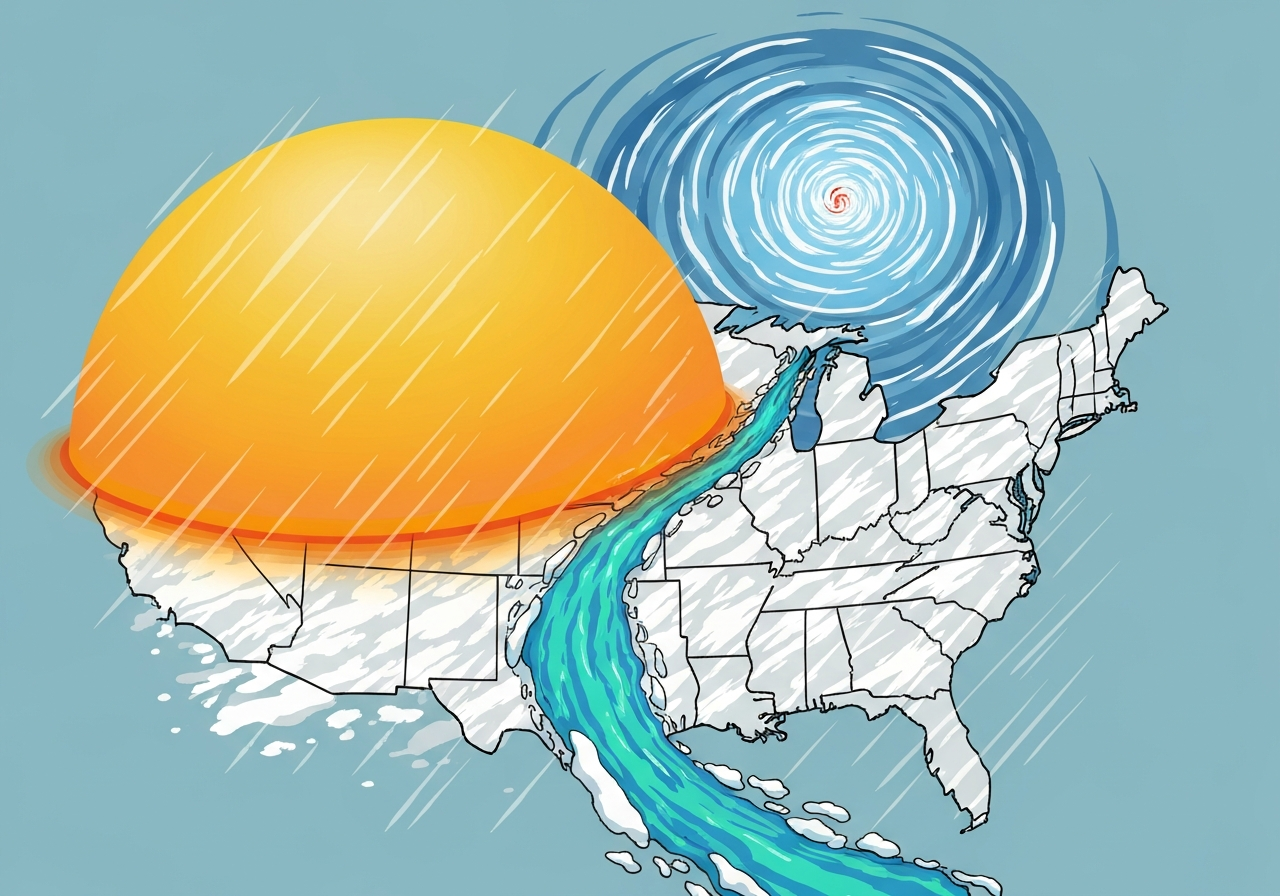
Forecasters say nearly the entire United States will be hit by contrasting weather extremes in the coming days: an early-season heat dome baking the Southwest, a polar vortex plunging Arctic air into the Midwest and East, two consecutive snow-producing storms across the northern tier and an atmospheric river bringing heavy rain to Hawaii. The pattern is unfolding this week, with parts of the country already seeing record warmth while other regions brace for snow, single-digit lows and flooding. Officials warn the juxtaposition of extremes — heat, cold, heavy snow and intense rain — will create heightened hazards for communities, infrastructure and emergency responders.
Key Takeaways
- Heat dome: Forecasts call for Phoenix to jump from about 98°F (37°C) to several days above 103–107°F (39–42°C) early next week, a timing unprecedented before March 26 in 137 years of records.
- Polar vortex chill: Minneapolis is expected to see lows near 0°F (-18°C) and Chicago single-digit lows on Tuesday, with overnight readings in parts of the Northeast and Mid‑Atlantic in the teens and 20s°F.
- Two snowstorms: Back-to-back systems along the northern tier could drop 3–4 feet of snow in some Great Lakes locales; the second storm is forecast to intensify rapidly and meet criteria for a bomb cyclone over land.
- Atmospheric river in Hawaii: Persistent heavy rainfall is forecast for parts of Hawaii, prompting flash‑flood warnings on Oahu and heightened flood risk statewide.
- Alaska anomaly: Much of Alaska is forecast to run roughly 30°F (about 17°C) colder than typical for this season, deepening local cold impacts.
- Recent severe weather: Tornadoes in the past week have killed at least eight people across Oklahoma, Michigan and Indiana, underscoring heightened storm risks this season.
- Jet stream role: A highly amplified, near-vertical jet stream pattern is funneling sharp temperature contrasts and steering storms in unusual tracks.
Background
The United States is entering a period of rapid weather swings driven by a highly distorted jet stream that is transporting air masses in unusually steep north-south motions. The jet stream’s amplified waves are allowing Arctic air to plunge southward while ridging over the West traps heat, producing near‑adjacent extremes. This configuration amplifies standard seasonal variability and raises the potential for record-setting conditions in both temperature and precipitation.
Experts have linked episodes of a wavier jet stream and polar vortex intrusions in part to long-term changes in Arctic conditions, including reduced sea ice and altered thermal gradients. While attribution of any single event to human-caused climate change requires careful analysis, the backdrop of a warming planet can intensify certain extremes — for example, allowing stronger atmospheric rivers or producing warmer extremes earlier in the year than historically typical. Emergency managers, utilities and municipalities generally prepare for separate heat or cold events; the concurrence of several hazards complicates response and recovery logistics.
Main Event
In Southern California and parts of the Southwest, anomalous warm air is already in place. Los Angeles recorded unusually high temperatures in the 90s (°F) this March, drawing people outdoors in shorts and prompting heat‑related discomfort. Forecast guidance indicates a heat dome building early next week over the Southwest that will yield multiple consecutive days of triple‑digit temperatures in Phoenix — potentially reaching 103–107°F (39–42°C) after an initial 98°F reading.
Concurrently, meteorologists project a strong polar vortex excursion to push frigid Arctic air into the Midwest and East. Forecast lows center on near‑zero°F readings for Minneapolis and single digits for Chicago; the cold plunge will be felt as far southeast as parts of the Mid‑Atlantic and may bring lows into the 20s°F as far south as Atlanta. Such rapid temperature falls will stress heating systems and raise the risk of freeze damage where soils and infrastructure have begun spring thawing.
Two separate storm systems traversing the northern United States are expected to deliver heavy snowfall across the Great Lakes and adjacent states. The first system arrives late in the week, followed by a stronger second system Sunday into Monday. Models indicate the second storm’s central pressure will deepen quickly — an explosive intensification that meets the informal definition of a bomb cyclone — increasing winds, blizzard risk and coastal impacts in affected areas.
Far from the continental mainland, Hawaii will face prolonged, heavy rainfall as an atmospheric river sets up, triggering flash‑flood warnings on Oahu and widespread flood concerns across the islands. Alaska, by contrast, is forecast to experience temperatures around 30°F colder than climatological expectations for this time of year, compounding seasonal disruptions for transportation and communities in the state.
Analysis & Implications
The overlapping hazards create compounding risks: heat waves threaten human health, electric grid demand and wildfire potential, while simultaneous heavy snow and Arctic air increase transportation hazards, power outages and structural load concerns. Utilities in the Southwest may face higher peak cooling demand earlier than planned, while Midwest and East grid operators must prepare for increased heating loads during the cold snap.
Infrastructure stress is a central concern. Freeze–thaw cycles following a warm spell can rupture water mains and weaken roads; heavy snow plus high winds raises the chance of prolonged outages and downed trees. Emergency and public works departments will need to allocate resources across multiple response fronts, complicating prioritization when events overlap geographically or temporally.
Economically, agriculture and early‑season planting could suffer from the abrupt cold in regions that have begun spring growth, while tourism and outdoor recreation are subject to both disruption and sudden shifts in demand. Insurance and disaster relief costs could rise if the forecasted heavy snows, floods and severe storms materialize at scale.
From a climate perspective, scientists caution that while extreme variability is part of late‑winter/early‑spring transitions, the increased prevalence of pronounced jet‑stream waviness and stronger water‑vapor transport in atmospheric rivers is consistent with observed changes linked to Arctic warming and a warmer atmosphere’s greater moisture capacity. Attribution studies after the events will be required to quantify the human influence on specific outcomes.
Comparison & Data
| Location | Expected Extremes | Typical/Record Context |
|---|---|---|
| Phoenix, AZ | 98°F → 103–107°F (37→39–42°C) over several days | In 137 years of records, never reached 100°F before March 26; first 100°F usually in early May |
| Minneapolis, MN | Lows near 0°F (-18°C) | Seasonal lows typically higher in late March; significant below‑normal |
| Great Lakes region | 3–4 ft snow in places from two storms | Heavy snow is not unusual, but sequential large totals and a bomb cyclone are notable |
| Oahu, Hawaii | Persistent heavy rain, flash‑flood warnings | Atmospheric rivers deliver episodic heavy rain; this event is prolonged |
These figures synthesize forecast model ensembles and the Weather Prediction Center’s guidance. The Phoenix temperature progression is notable because of the long pre‑1940s record that shows typical first 100°F readings later in spring; the snowfall totals reflect model clusters indicating widespread deep snow where coastal enhancements and lake effects combine.
Reactions & Quotes
Weather service forecasters described the nation-wide pattern as unusually amplified and noted it will deliver rapid transitions between extremes across short distances.
“All of the country, even if you’re not necessarily seeing extremes, are going to see generally changing from cold to warm, or warm to cold to warm.”
Marc Chenard, Weather Prediction Center (NOAA)
Former NOAA scientists highlighted the breadth of the forecast and the potential for unprecedented early heat in some locations while acknowledging uncertainty in exact totals and timing.
“I expect extreme weather in all 50 states,”
Ryan Maue, former NOAA chief scientist
Local residents in heat‑affected areas reported discomfort and altered routines as temperatures surged unusually early in the season.
“The back of my neck was melting,”
Shane Dixon, Culver City resident
Unconfirmed
- The precise footprint and maximum snow totals for the second storm remain model-dependent and could shift east or west before landfall.
- The statement that every U.S. state will experience an extreme event is a forecast expectation and not yet verified by observations for the full 50‑state domain.
- Projections of infrastructure damage and outage counts are preliminary; detailed impact assessments require event-by-event reporting.
Bottom Line
This week’s pattern features tightly packed extremes — heat, cold, heavy snow and intense rain — driven by an unusually wavy jet stream. Communities from the Southwest to the Great Lakes and from Hawaii to Alaska should prepare for hazard‑specific impacts: heat safety and cooling demands in the Southwest, snow and wind hazards in the northern tier, flooding in Hawaii and extreme cold threats in parts of the interior.
Public officials, utilities and residents should monitor local National Weather Service forecasts and advisories, adjust plans for transportation and outdoor work, and be ready for rapidly changing conditions. Post‑event analyses will help clarify the role of longer‑term climate trends in amplifying these compound extremes.
Sources
- The Associated Press — news report summarizing forecasts and impacts (news)
- National Weather Service / Weather Prediction Center — official forecast guidance and warnings (official meteorological agency)
- National Oceanic and Atmospheric Administration (NOAA) — climate context and scientific resources (federal science agency)