
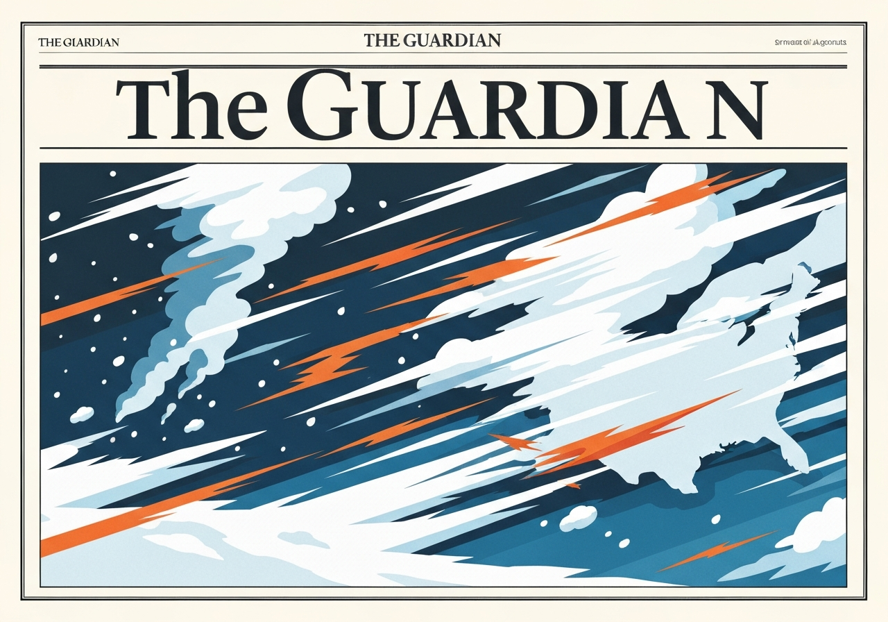
A large, complex storm system tracked across the United States from Sunday into Monday, producing heavy snow in the upper Midwest, damaging winds across the Plains and late-season thunderstorms that threaten the mid‑Atlantic and Washington, D.C. Forecasters warned that the system — described by AccuWeather as a “triple‑threat March megastorm” — could affect nearly 200 million people and cause widespread travel and power disruptions. Blizzard warnings and more than 20 inches (50 cm) of snow were reported in parts of southeastern Minnesota and western Wisconsin, while meteorologists flagged an elevated risk of damaging winds and a few tornadoes from the Carolinas through the mid‑Atlantic. Officials urged residents to monitor local alerts as the storm moved eastward and intensified into a rapidly deepening low-pressure system.
Key takeaways
- AccuWeather said the storm could impact nearly 200 million people across the continental United States, with significant multi-hazard threats of snow, wind and severe thunderstorms.
- More than 20 inches (50 cm) of snow were reported in parts of southeastern Minnesota and western Wisconsin, and central Wisconsin to Michigan’s Upper Peninsula was forecast to see more than 2 feet (60 cm) in places.
- FlightAware recorded over 600 cancellations at Minneapolis–Saint Paul airport on Sunday, with additional cancellations through Detroit and other hubs expected to grow.
- PowerOutage.us reported more than 210,000 utility customers without electricity across six Great Lakes states as of Sunday afternoon; some outages began when gusts reached about 85 mph (135 km/h).
- NWS advisories indicated a line of severe storms would cross the Mississippi, Tennessee and Ohio valleys and reach the eastern seaboard by late Monday, threatening damaging straight‑line winds and several tornadoes.
- Nebraska emergency officials said roughly 30 National Guard personnel were deployed to help fight wildfires that, as of Saturday, had burned more than 900 sq miles (2,330 sq km) and caused at least one fatality.
Background
The storm formed where a deep, rapidly intensifying low met cold Arctic air over the northern Plains and abundant Gulf moisture to the south. That contrast allowed the system to produce heavy snowfall where cold air held and severe convection where warm, unstable air pushed north. Meteorologists used the term “bomb cyclone” to describe the rapid pressure drop that helped turbocharge wind fields and tighten the gradients between rain, snow and thunderstorm zones.
Late‑season severe weather is not unprecedented, but this event combined winter hazards and convective threats across a broad corridor, complicating forecasts and response. Federal and state agencies, electric utilities and transportation operators prepared for overlapping impacts: deep snow and blowing drifts in the Midwest, high winds that could down lines across the Plains, and damaging thunderstorms with embedded tornado potential in the mid‑Atlantic. Public safety messaging focused on layered risks and the need for local situational awareness, shelter planning and travel avoidance where feasible.
Main event
In the upper Midwest, snow fell heavily on Sunday, with National Weather Service reports noting more than 20 inches (50 cm) in parts of southeastern Minnesota and western Wisconsin. Blizzard warnings were in effect in several counties; plow operators reported drifts stacking as high as truck beds and visibility dropping to near zero on rural highways, forcing closures and stranding some motorists.
Ground operations at Minneapolis–Saint Paul International Airport were significantly disrupted: FlightAware logged more than 600 canceled departures and arrivals on Sunday, and additional cancellations were reported through Detroit and other Midwest hubs. City crews and residents described a steady cycle of clearing ahead of new bursts of snow as winds continued to gust through the event.
Across the Plains, strong winds accompanied snow and cold, producing rapid ice accretion and extensive power outages. PowerOutage.us listed over 210,000 customers without service across six Great Lakes states by Sunday afternoon; utilities attributed many outages to gusts that reached about 85 mph (135 km/h) in parts of the region. In Nebraska, gusty conditions helped large wildfires spread: state officials said more than 900 square miles (2,330 sq km) had burned and that roughly 30 National Guard members were mobilized to assist local response teams.
Forecasters forecast a transition by late Sunday into a severe‑weather regime farther east. The National Weather Service predicted a corridor from parts of South Carolina through Maryland — including Raleigh, Richmond and Washington, D.C. — would face the highest chance for damaging winds and several tornadoes on Monday afternoon. In addition, forecasters warned of intense, short‑duration rainfall near New York City into southern New England, where localized rates of 0.5–1 inch in under an hour could trigger urban flash flooding.
Analysis & implications
The breadth of hazards — heavy snow, high winds, wildfire spread potential and severe convective storms — increases operational complexity for emergency managers. Utilities must prioritize crews for widespread outages while airports and surface transportation contend with icy runways and impassable roads. The simultaneous nature of those demands can stretch resources thin across states and regions.
Economically, the storm threatened to disrupt freight and passenger movements at a time when supply chains remain sensitive to single‑day interruptions. Major cancellations at regional hubs can cascade, leaving aircraft, crews and supplies out of position for days. Local businesses in storm‑hit corridors face lost sales and additional recovery costs tied to power outages and property damage from wind and fire.
From a public‑safety standpoint, the risk of tornadoes near densely populated mid‑Atlantic communities raises stakes: even a brief, intense tornado or a line of 70–90 mph straight‑line winds can cause concentrated structural damage, utilities failures and injuries. Officials emphasized preparedness steps — move to interior rooms away from windows, have a charged phone and backup power for medical devices, and avoid nonessential travel until threats pass.
Comparison & data
| Region / Metric | Observed / Forecast |
|---|---|
| Southeastern Minnesota & western Wisconsin (snow) | >20 in (50 cm) |
| Central Wisconsin to Michigan Upper Peninsula (snow) | >24 in (60 cm) locally |
| Minneapolis–Saint Paul cancellations | >600 flights (FlightAware) |
| Great Lakes power outages | >210,000 customers (PowerOutage.us) |
| Peak gusts reported earlier | ~85 mph (135 km/h) |
| Nebraska wildfires (area burned) | >900 sq miles (2,330 sq km) |
The table above summarizes the largest confirmed figures available during the event window. Localized totals will be revised as surveys and utility assessments proceed; snowfall and wind reports are subject to post‑event verification. Comparisons to climatological March averages show these are well above typical single‑storm accumulations for many affected locations in the upper Midwest and unusual for early‑season tornado threats in parts of the mid‑Atlantic.
Reactions & quotes
“If several atmospheric factors align, this could become one of the most impactful early‑season severe events in the mid‑Atlantic in recent memory.”
Jonathan Porter, AccuWeather chief meteorologist
Porter’s assessment framed the forecasters’ concerns about overlapping hazards. He highlighted the possibility of damaging straight‑line winds and a few tornadoes, including an elevated concern for the Baltimore–Washington corridor.
“A line of severe storms will cross much of the eastern U.S. by late Monday; expect widespread damaging winds and several tornadoes in parts of the mid‑Atlantic.”
National Weather Service (forecast discussion)
The NWS statement set timing and primary threats, urging residents in the projected path to be ready to act on short notice and to follow local warnings as the line progresses east.
“You can’t see anything when you’re on the highways outside of the city.”
Aaron Haas, snowplow operator, Wisconsin
Field reports from plow operators and residents described whiteout conditions and repeated clearing efforts, underscoring how quickly snow and blowing conditions reduced travelability.
Unconfirmed
- Specific tornado counts and final damage assessments for mid‑Atlantic locales remain provisional until local storm surveys are complete.
- Wildfire acreage and exact causes in Nebraska are still under investigation and may be updated as containment improves and access expands.
- Economic loss estimates, including infrastructure and business interruption impacts, are not yet available and will require post‑event reporting.
Bottom line
This event combined multiple fast‑moving, high‑impact hazards across a broad swath of the United States, creating a rare overlap of heavy snowfall, hurricane‑force gusts and severe convective storms. The most immediate public risks were travel disruptions, localized flooding from intense rainfall rates in urban areas, downed power lines and the potential for tornadoes in densely populated mid‑Atlantic corridors.
Residents in the threatened regions should follow local National Weather Service advisories, expect continued disruptions to flights and road travel for several days, and plan for possible extended power outages. Emergency managers and utilities will be assessing damage and restoring services, but the scale and overlap of hazards mean recovery efforts could take time in the hardest‑hit communities.
Sources
- The Guardian (news report)
- AccuWeather (commercial forecasting analysis)
- National Weather Service (official forecasts and warnings)
- FlightAware (flight tracking data)
- PowerOutage.us (utility outage aggregator)
- Nebraska Emergency Management Agency (state emergency updates)
- Associated Press (news reporting)