
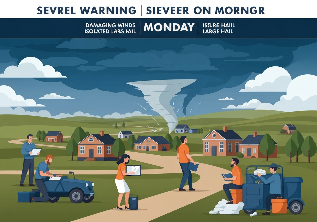
Lead: Strong storms are expected to pass through Upstate South Carolina and parts of western North Carolina Monday morning, with the primary window from about 4 a.m. to noon and the Upstate focused on 5 a.m. to noon. Meteorologists warn of a multi-hazard event that may include damaging straight-line winds, isolated tornadoes, large hail and heavy rainfall, which could disrupt the morning commute. Behind the line, a powerful cold front will produce a wind advisory for higher elevations in western North Carolina, with gusts forecast around 50–60 mph. A brief burst of snow is also possible across higher terrain of WNC later Monday as the front departs.
Key Takeaways
- Timing: Severe threat window is 4:00 a.m. to noon Monday; primary Upstate timing 5:00 a.m.–noon, potentially affecting morning travel.
- Wind threat: Damaging straight-line gusts are expected, with winds of roughly 50–60 mph possible above 3,500 feet in western North Carolina.
- Tornado risk: Forecasters list isolated tornadoes as possible within embedded cells or along intense line segments.
- Hail and rain: Large hail and heavy rainfall are on the table, increasing localized flash-flooding and damaging impacts to vehicles and structures.
- Post-front cold: Tuesday and Wednesday will be notably colder; Tuesday morning wind chills in WNC in the single digits and teens, Upstate and NE Georgia in the teens and 20s.
- Snow chance: A short burst of light snow is likely in western North Carolina by Monday afternoon, mainly producing light accumulation on elevated surfaces.
Background
The setup stems from a strong mid-latitude cold front advancing across the Southeast ahead of a deepening low pressure. A humid, unstable airmass in place over the Carolinas overnight will provide fuel for convective storms as the front approaches. Terrain in the Upstate and the mountains of western North Carolina complicates forecasting because small shifts in timing and track can markedly change local outcomes. Local forecast offices have issued a mix of watches/advisories and the station notes a Wind Advisory for high elevations above 3,500 feet in western North Carolina.
Past springtime events in the region have produced damaging straight-line winds and isolated tornadoes with only a few hours’ notice, underscoring the need for preparedness during morning commutes. The combination of daytime heating preceding frontal passage and strong low-level wind shear can support rotating cells embedded within a squall line. Emergency managers and transit authorities typically elevate readiness during such impact-day forecasts; power outages and downed trees are frequent consequences when gusts exceed 50 mph.
Main Event
Forecasters describe Monday as an Impact Day for severe storms: a line of storms is expected to develop and move through from early morning into late morning. The greatest concentration of severe weather is forecast to move east of the viewing area by afternoon, but a slower progression would bring the higher-risk period into the heart of the Upstate. Timing remains the critical uncertainty — a delayed frontal push increases the local severe threat.
During the main window, scattered to numerous severe storms could produce damaging straight-line winds capable of toppling trees and causing structural damage. Embedded within the line, isolated tornadoes are possible, especially where low-level rotation intensifies beneath stronger updrafts. Large hail is also a concern in more discrete severe updrafts, posing a risk to vehicles, crops and rooftop materials.
After the line moves through, much colder air will funnel into the region behind the front. The National Weather Service and local forecasters expect gusts near 50–60 mph in high terrain of western North Carolina, prompting the Wind Advisory for areas above 3,500 feet. As temperatures drop Monday afternoon and evening, a brief period of light snow may fall on elevated surfaces in WNC, with little to no accumulation expected at low elevations.
Analysis & Implications
This event illustrates how small timing differences can change impacts across a compact forecast area. If the line accelerates, the worst weather will shift east and spare portions of the Upstate; if it slows, damage potential in the Upstate rises and the morning commute faces greater disruption. Transportation authorities should prepare for rapid-onset hazards during morning hours and adjust routes or schedules as needed.
Economically, high winds and hail can produce localized but significant losses — downed power lines, damaged roofing, and automotive glass claims typically spike after such events. Utilities and municipal crews should stage resources for tree and limb removal and potential outage restoration given the forecasted 50–60 mph gusts at elevation. Agricultural interests should also heed hail and wind threats to vulnerable crops and equipment.
From a public-safety standpoint, the isolated tornado threat — while low in probability — calls for active alerting strategies because even a single touchdown can have outsized consequences. Emergency managers should emphasize robust, multi-channel warnings (mobile alerts, sirens, broadcast) during the early-morning window when many people are commuting and may not be monitoring forecasts closely.
Comparison & Data
| Element | Forecast/Value |
|---|---|
| Main severe window | 4:00 a.m. – noon (Upstate: 5 a.m. – noon) |
| Wind gusts (WNC >3,500 ft) | 50–60 mph |
| Snow (WNC) | Brief burst; light accumulation mainly on elevations |
| Tuesday morning wind chills | WNC: single digits–teens; Upstate & NE GA: teens–20s |
The table places this event in context with recent spring storms that produced similar wind gusts but varied in tornado reports. Historically, severe events during rapid frontal passages yield higher wind damage than long-lived hail events across the Upstate. Forecasters emphasize that the numerical values above reflect the most likely scenarios but are sensitive to small changes in timing and mesoscale structure.
Reactions & Quotes
Local station leadership highlighted the weather team’s accuracy record and the tools used to track the system, framing preparedness as a community priority.
“Our goal every day, in every forecast is accuracy,” said WYFF 4 President and General Manager Blake Bridges, noting the station’s forecasting resources and certification.
Blake Bridges, WYFF 4 (station management)
An independent verification firm noted the challenges of forecasting across the Upstate and mountain areas and praised the station’s track record in difficult conditions.
“The station that gets the forecast right more than anyone else is Chief Meteorologist Chris Justus and the WYFF News 4 weather team,” said WeatheRate President Bruce Fixman, referring to the market certification.
Bruce Fixman, WeatheRate (independent research firm)
Forecasters urge residents to monitor official updates, secure loose outdoor objects and have multiple ways to receive warnings Monday morning. These operational recommendations are consistent with best practices for short-fuse severe weather events.
Unconfirmed
- Exact placement of any isolated tornadoes remains uncertain; forecasters can identify risk zones but not precise touchdown locations ahead of time.
- Snow accumulation amounts in western North Carolina are uncertain and expected to be light and elevation-dependent; timing of onset could shift with frontal speed.
- Whether the severe line will slow enough to raise the Upstate’s overall tornado probability is conditional on mesoscale evolution that may not be resolved until a few hours prior.
Bottom Line
Monday’s early-morning to late-morning frontal passage presents a credible threat for damaging winds, isolated tornadoes and large hail across Upstate South Carolina and parts of western North Carolina. The primary risk window is 4 a.m. to noon, with the Upstate most vulnerable from about 5 a.m. to noon — conditions that overlap peak commuting hours and elevate the potential for harm and disruption.
Residents and officials should plan for rapid-onset impacts: secure outdoor items, prepare for power outages in vulnerable areas (especially above 3,500 feet), and ensure multiple alerting methods are enabled for mobile and home devices. Monitor updates from the National Weather Service and local forecast offices for watches or warnings that may be issued as the situation evolves.
Sources
- WYFF News 4 (local television station reporting and forecast)
- WeatheRate (independent forecast verification firm)
- National Weather Service (official federal weather forecasts and advisories)