
Lead
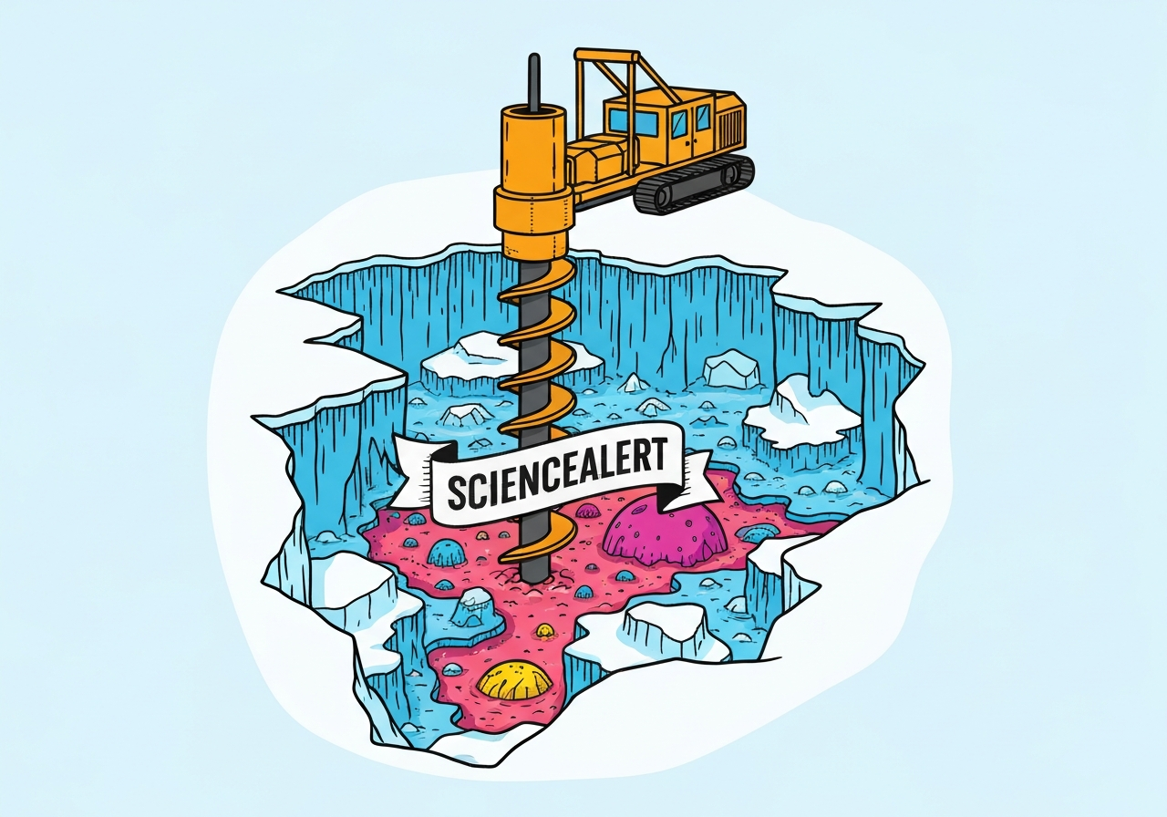
A 29-researcher international team has drilled deeper beneath the West Antarctic Ice Sheet than ever before at Crary Ice Rise, retrieving 523 metres of ice and 228 metres of underlying sediment. The cores contain shell fragments and other marine material that indicate the site was open ocean, at least intermittently, as far back as 23 million years. The region holds enough ice to raise global sea levels by an estimated four to five metres if fully lost. Researchers hope these direct geological records will clarify past ocean temperatures and the conditions that drove ice retreat, improving projections for future melting.
Key Takeaways
- The drilling reached 523 metres of ice and 228 metres of sediment at Crary Ice Rise on the Ross Ice Shelf, creating a continuous record down to material dated as old as 23 million years.
- The sediment contains shell fragments and remains of light-dependent marine organisms, which are more consistent with open-ocean or ice-shelf-margin conditions than subglacial deposits.
- The West Antarctic Ice Sheet contains enough ice to raise global sea levels by four to five metres if fully lost, according to the research team.
- Satellite data show the ice sheet has been losing mass at an accelerating rate in recent decades, but model thresholds for rapid collapse remain uncertain.
- Cores were transported more than 1,100 kilometres across the Ross Ice Shelf to Scott Base for onward shipment to New Zealand laboratories for detailed analysis.
Background
The West Antarctic Ice Sheet (WAIS) and its floating Ross Ice Shelf have long been central to global sea-level risk discussions because parts of WAIS rest on bedrock below sea level, making them vulnerable to warm ocean water. Past reconstructions have suggested episodes of retreat and ice-shelf collapse, but until now most geological evidence came from sites distant from key grounding zones. Ice-sheet modelers therefore relied on indirect proxies and records from other regions when calibrating thresholds for instability. Better, locally recovered geological sequences are needed to tie past ice behavior to contemporaneous ocean and atmospheric conditions. Those constraints are essential to reducing uncertainty in projections of how fast Antarctic ice could contribute to sea-level rise under future warming scenarios.
Crary Ice Rise sits on the Ross Ice Shelf and acts as a pinning point that influences ice flow and stability around the shelf. When ice shelves thin or collapse, grounded ice upstream can accelerate seaward and contribute to sea-level rise. The international team, led by Earth Sciences New Zealand, Victoria University of Wellington and Antarctica New Zealand, undertook the operation to directly sample the interface where ice meets ocean-proximal sediments. That approach contrasts with earlier work that used more remote sedimentary records or surface-based geophysical inferences. The new cores therefore offer a higher-resolution window into local environmental change spanning millions of years.
Main Event
The drilling campaign completed in January, with the team recovering a total of 523 metres of ice followed by 228 metres of sediment below the ice at Crary Ice Rise. Initial visual and sedimentological inspection found intervals typical of sub-ice deposition as well as layers containing shell fragments and remains of organisms that require light, implying episodes of open water or an ice-shelf margin. Co-chief scientist Molly Patterson (Binghamton University) noted some deposits match what is expected under an active ice shelf today, while other intervals clearly reflect marine conditions with exposure to sunlight and open-water ecosystems.
Fellow co-chief Huw Horgan (Victoria University of Wellington) said preliminary dating and stratigraphic interpretation indicate the sequence spans up to 23 million years, encompassing periods when global average temperatures exceeded two degrees Celsius above pre-industrial levels. The team aims to extract paleoceanographic proxies—such as microfossils and geochemical indicators—from the sediment to estimate past ocean temperatures and salinity that accompanied local ice retreat. Establishing those environmental parameters is key to linking observed retreat to specific climate drivers rather than relying solely on correlative evidence from distant sites.
After extraction, core packages traveled roughly 1,100 kilometres across the Ross Ice Shelf to Scott Base, from where they will be shipped to New Zealand laboratories for high-resolution analysis. The transport and handling are designed to preserve fragile microfossils and chemical signatures needed for paleoenvironmental reconstruction. The international team of 29 researchers plans coordinated laboratory campaigns to generate age models, microfossil inventories and isotopic temperature estimates across the recovered sequence. Those data will feed into regional ice-sheet models to test sensitivities to ocean warming and other forcings.
Analysis & Implications
The direct evidence for open-ocean conditions at Crary Ice Rise strengthens the case that the Ross Ice Shelf and parts of WAIS retreated substantially in past warm intervals. If past retreat corresponded with specific ocean temperature ranges, modelers can use those thresholds to assess the risk of similar responses under projected warming. However, paleo-responses occurred over geological timescales and under different boundary conditions, so translating those results into century-scale predictions will require careful, model-constrained interpretation. The cores provide boundary conditions that can reduce the broad uncertainty in current ice-sheet projections by anchoring models to local geological reality.
A confirmed presence of open ocean at times of elevated global temperatures implies that ocean forcing—warmer water reaching the ice-shelf base—was an important driver of past retreat. That mechanism is consistent with contemporary observations showing warm Circumpolar Deep Water intrusions can accelerate basal melt. Better quantification of past ocean temperatures from the cores will therefore be directly relevant to estimating how modern ocean warming might destabilize ice shelves and grounded ice. If the cores show sustained open-ocean conditions during relatively modest warming, it would indicate a lower threshold for rapid ice loss than some models currently assume.
Policy and adaptation planning depend on credible timelines for sea-level contributions; geological constraints help determine whether large-scale ice loss is likely over decades, centuries or millennia. The new direct records do not by themselves provide precise rates of future loss, but they narrow plausible scenarios by ruling out some model behaviors inconsistent with the sedimentary evidence. International coastal planning, insurance markets and infrastructure investments will benefit indirectly as models incorporating the new data produce tighter probability ranges for sea-level rise through the 21st century and beyond.
Comparison & Data
| Metric | Value |
|---|---|
| Ice depth drilled | 523 metres |
| Underlying sediment recovered | 228 metres |
| Maximum interpreted age | ~23 million years |
| Estimated global sea-level equivalent (WAIS) | 4–5 metres |
| Core transport distance to Scott Base | ~1,100 kilometres |
The table summarizes the campaign’s primary measured outcomes and contextual figures cited by the team. Previous boreholes in the broader region reached shallower sediment or relied on indirect seismic interpretations, making this campaign notable for its unprecedented sediment depth beneath a major ice-rise feature. Comparing these direct cores with other Antarctic and Southern Ocean records will help build a spatially resolved picture of past ice and ocean states. That comparison is essential because local responses can vary with bathymetry, ocean circulation and ice-sheet geometry.
Reactions & Quotes
Leading scientists and agencies emphasized both the technical achievement and the scientific importance of the cores. The field lead characterized the sediments as providing the first clear, local record tying open-ocean conditions to the Crary Ice Rise region over deep time.
“Some of the sediment was typical of deposits that occur under an ice sheet like we have at Crary Ice Rise today, but other layers include shell fragments and organisms that need light,”
Molly Patterson, Co-chief Scientist (Binghamton University)
The project co-lead highlighted the multi-million-year span of the sequence and its relevance to periods when global temperatures were considerably warmer than pre-industrial levels.
“Initial indications are that the samples span the past 23 million years, including intervals with global temperatures well above two degrees Celsius over pre-industrial,”
Huw Horgan, Co-chief Scientist (Victoria University of Wellington)
The international team issued an initial statement noting the urgent need to tie satellite-observed mass loss to geological thresholds of collapse, while acknowledging remaining uncertainties that the cores aim to reduce.
“Satellite observations show the ice sheet is losing mass at an accelerating rate, but there is uncertainty around the temperature increase that could trigger rapid loss of ice,”
Research team initial report (multi-institutional)
Unconfirmed
- Precise ocean temperatures at the times of local open-water intervals are not yet published and require lab-based geochemical analysis of the cores.
- The rates at which past retreats occurred at Crary Ice Rise are not yet constrained; sedimentation rates and dating uncertainties mean timing will be refined in subsequent studies.
- Whether the local open-ocean intervals directly triggered widespread WAIS collapse remains subject to model testing and comparison with other regional records.
Bottom Line
This drilling campaign provides the first deep, local sedimentary archive from beneath a key Ross Ice Shelf feature, offering direct evidence that Crary Ice Rise experienced open-ocean conditions intermittently over the past 23 million years. Those records are pivotal for constraining the oceanic and climatic conditions that accompany ice-shelf retreat, and they reduce reliance on distant proxy sites when calibrating ice-sheet models. While the cores do not by themselves set precise thresholds for near-term collapse, they supply critical boundary conditions that will narrow uncertainty in future model projections.
Over the next months to years, laboratory analyses and model experiments using these cores should sharpen estimates of how sensitive the Ross Ice Shelf and WAIS are to ocean warming. That improved understanding will feed directly into risk assessments for coastal planning and international mitigation strategies. For policymakers and coastal managers, the key takeaway is that geological evidence now complements satellite observations—together they can produce stronger, more locally grounded projections of future sea-level rise.
Sources
- ScienceAlert (media report citing the initial research statement)
- Antarctica New Zealand (official agency coordinating Antarctic logistics and research)
- Victoria University of Wellington (academic lead institution; research team page)