
Central North Carolina faces a rare Level 4-of-5 severe-weather risk on Monday, March 16, 2026, as a strong cold front moves through the region. The National Weather Service and local agencies warned that widespread thunderstorms, damaging wind gusts and the potential for several long-track tornadoes could occur, with a Tornado Watch in effect for parts of central North Carolina, including the Triangle. Areas away from storms can still expect gusts near 40 mph and power outages are possible across the region. The heightened risk is expected to subside near sunset, with colder air arriving overnight and temperatures falling into the upper 20s to low 30s.
Key Takeaways
- Level 4 of 5 severe-risk issued for central North Carolina for Monday, March 16, indicating a high probability of widespread severe storms.
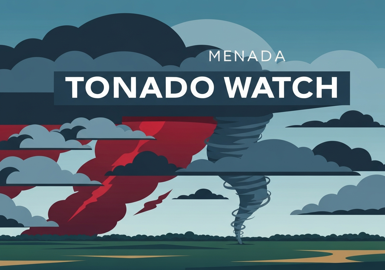
- A Tornado Watch covers parts of central NC, including the Triangle; forecast models indicate a few long-track tornadoes are possible.
- Damaging wind gusts are likely during storms; non-thunderstorm gusts around 40 mph are expected regionwide, raising the risk of power outages.
- Storm threat should diminish by sunset Monday; lingering showers are possible through the night and should end before midnight.
- High temperatures Monday will be in the upper 60s to low 70s; overnight lows will fall sharply to the upper 20s–low 30s as colder air moves in.
- Multiple school systems announced closures or remote learning for Monday, including Wake, Durham and Chapel Hill-Carrboro.
- Nighttime winds may gust up to 32 mph with lows near 31°F; colder, drier conditions return on Tuesday with highs in the upper 40s to around 50°F.
Background
The March 16 threat stems from a strong cold front advancing across the Southeast that will tap into unusually warm, moist air at the surface. When such air masses collide with a fast-moving upper-level trough, the atmosphere becomes favorable for organized severe convection—lines and discrete supercell storms that can produce tornadoes and long-lived damaging winds. The Storm Prediction Center and local National Weather Service offices use a five-tier risk scale; Level 4 (“moderate risk”) is reserved for events with a significant chance of widespread damaging weather and occasional significant tornadoes.
Central North Carolina sits in a corridor that has seen late-winter and early-spring severe events in past years, but a Level 4 designation remains uncommon and prompts heightened preparedness by emergency managers and school systems. Utilities and county officials monitor the potential for outages given forecast gusts and the density of tree cover in many suburban and rural parts of the region. Public-safety messaging typically emphasizes sheltering plans, securing outdoor items, and heeding local warnings during watches and warnings.
Main Event
Forecasters said scattered-to-widespread thunderstorms should develop ahead of the cold front during Monday afternoon and continue into the evening. Models and human forecasters are signaling a multi-mode severe outbreak: forward-progressing squall lines capable of widespread damage and embedded supercells that can produce longer-track tornadoes. The Tornado Watch issued for portions of central North Carolina, including the Triangle, means conditions are favorable for tornado formation over a broad area.
Even where thunderstorms do not form, persistent west-to-northwest winds are forecast to gust near 40 mph during the day, raising the likelihood of downed branches and isolated power failures. Utility companies warned that outages could occur and advised preemptive safety measures for residents who rely on electricity-dependent medical equipment. Emergency management agencies urged residents to have a plan for moving to an interior, windowless room if a tornado warning is issued.
Local school districts responded by canceling in-person instruction or shifting to remote learning for Monday. The list of closures and delays included Chapel Hill-Carrboro, Cumberland, Durham, Johnston, Lee, Moore, Orange, Robeson and Wake counties; Harnett used remote learning; Wayne County dismissed early. Officials cited both the direct hazard from storms and safety concerns for student transport during high winds and heavy rain.
Analysis & Implications
A Level 4 risk elevates the impact expectations beyond isolated severe storms to a more consequential regional episode. Several implications follow: first, emergency-response resources may be stretched if multiple tornadic or high-wind incidents occur across different counties; second, utility restoration times could lengthen if damage is widespread; third, transportation—especially bus and commuter operations—may be disrupted during peak storm periods and in the immediate aftermath.
Economically, even a single long-track tornado or extended outage can produce outsized local costs—damaged homes, interrupted work, and impacts to small businesses—so the risk level prompts municipal leaders to prepare mutual-aid agreements and staging for crews. Politically, high-impact weather events that affect schools and critical infrastructure often become focal points for after-action reviews about preparedness, tree-trimming programs and stormwater/power resilience investments.
Looking ahead, the rapid temperature drop forecast for Monday night into Tuesday—highs falling from the upper 60s/low 70s to around 50°F on Tuesday and lows near freezing—underscores a classic March transition that can enhance severe risk during the frontal passage. That steeper lapse rate supports stronger updrafts, increasing the chance that storms become severe and better organized. While the primary severe window is Monday afternoon into evening, residual hazards (downed trees, intermittent power) may persist into Tuesday morning.
Comparison & Data
| Metric | Monday Forecast | Typical Non-Severe Day |
|---|---|---|
| Severe Risk Level | 4 of 5 (moderate) | 1–2 (marginal to slight) |
| Peak wind gusts (non-storm) | ~40 mph | 10–20 mph |
| Overnight low | Upper 20s–low 30s | 40s–50s |
| Highs (day) | Upper 60s–low 70s | 60s |
| School closures (sample) | 10+ districts reported closed/remote | 0–1 |
The table summarizes key contrasts between the expected Monday environment and a routine day. The combination of high surface temperatures, strong low-level shear and an approaching cold front help explain the elevated severe risk. Emergency managers use this type of comparative data to prioritize resource staging, and utilities use gust forecasts to estimate outage likelihood and crew deployment.
Reactions & Quotes
“Residents should review their shelter plans now and be ready to move to a small interior room if warnings are issued,”
National Weather Service – Raleigh office (official)
The NWS statement emphasized preparedness rather than alarm, noting the unusual Level 4 designation and the chance of long-track tornadoes.
“We are positioning crews and coordinating with neighboring utilities to restore power as quickly and safely as possible if outages occur,”
Local electric utility (official)
Utility officials highlighted pre-event staging and cautioned that restoration timelines depend on storm damage and access to affected areas.
“We closed schools to keep students and staff out of potentially dangerous travel and shelter situations,”
Wake County Public School System (official)
District leaders said the decision reflected both the forecast hazards and logistical concerns for buses and family safety during severe weather and high winds.
Unconfirmed
- Specific counts and tracks of any tornadoes that might occur Monday evening are not known and will only be confirmed after storm surveys.
- Exact number and duration of power outages across counties are not yet confirmed; utility estimates may change after the event.
- Any reported injuries or structural damage during the event remain unverified until official damage assessments are completed.
Bottom Line
Monday’s Level 4 severe-weather risk for central North Carolina represents a significant threat that merits immediate attention from residents, schools, utilities and local governments. The combination of warm, moist air and a strong cold front creates an environment supportive of both damaging straight-line winds and a few long-track tornadoes; a Tornado Watch is already in effect for parts of the region, including the Triangle.
Practical steps: secure outdoor items, review family shelter plans, keep a battery-powered radio or reliable alert app on hand, and follow instructions from local emergency managers during watches and warnings. Expect conditions to improve after sunset as colder air arrives overnight, but be prepared for lingering impacts—downed trees, intermittent power and travel disruptions—into Tuesday morning.
Sources
- ABC11 / WTVD — local television news report summarizing the event and district closures (local news)
- National Weather Service – Raleigh — official forecast and warnings for central North Carolina (federal agency)
- Wake County Public School System — official district announcements on closures and early dismissals (local government/education)