
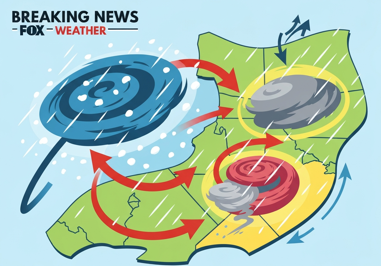
Lead: A fast-moving clipper is spreading light snow across Upstate New York and New England on Tuesday, with 1–3 inches common and up to 8 inches in higher terrain, while a separate cross-country storm is organizing to bring heavy rain and a potential severe-weather threat to the Deep South by the end of the week. Mountain communities in the Sierra Nevada are also seeing a significant surge in precipitation — including feet of snow at the highest elevations — offering short-term relief from a persistent West-wide snow drought. Localized hazards today include dense coastal fog in parts of the Gulf Coast and an elevated ice-jam flood risk along Nebraska rivers as a prolonged warm spell breaks up river ice.
Key Takeaways
- The Northeast clipper will produce roughly 1–3 inches of snow across Upstate New York and much of New England today; high-elevation totals in Vermont, New Hampshire and Maine could reach 6–8 inches.
- Sierra Nevada mountains are forecast to receive heavy mountain snow — model guidance points to 18 inches or more at the highest peaks, with up to two feet possible in favored locations.
- A major cross-country storm is expected to push Gulf moisture into the Deep South late week, creating heavy-rain and localized flash-flood risk across parts of Texas, Oklahoma, Arkansas and Tennessee this weekend.
- Ice-jam flood potential is elevated along the Platte, Elkhorn and Loup rivers in Nebraska as multi-day warmups fracture river ice, with water rises of 1–3 feet possible in a short span.
- Dense fog advisories cover large portions of the Deep South this morning, producing near-zero visibility and travel disruptions including a crash-related I-10 closure in Baldwin County, Alabama.
- Upper Colorado River Basin snow-water equivalent (SWE) is at a historically low level — about 57% of median for early February 2026 — raising concerns for Lake Powell inflows and downstream water supply.
- Long-range signals (PNA, ENSO trends, amplified West Coast trough) favor a more active late-February pattern; the February 21–28 window is flagged for above-normal storminess in the South.
Background
Clipper systems are compact, fast-moving low-pressure disturbances that typically originate over Canada and sweep southeastward across the U.S. These features often produce brief but sharp bursts of snow and wind, especially where cold air is entrenched. The current clipper moved into southern Ontario earlier Tuesday and is enhancing snowfall across New England this afternoon; its limited moisture supply keeps most totals modest away from high terrain.
The larger threat this week is a cross-country storm developing farther south and west. Meteorological patterns including a predicted amplified trough off the West Coast, a shift toward ENSO-neutral conditions, and a negative Pacific–North American (PNA) phase can combine to direct multiple lows across the High Plains into the Deep South. When Gulf moisture surges northward into that pattern, heavy rain and severe thunderstorms can follow.
Main Event
Across the Northeast, roads will become slippery late this afternoon and into the evening commute as light to moderate snow spreads into the Boston area between roughly 3–6 p.m. ET. The National Weather Service has issued Winter Weather Advisories beginning at 6 p.m. ET for eastern Massachusetts where accumulations are expected to average 1–3 inches, with isolated spots near 4–5 inches overnight.
In the Sierra Nevada, a weak atmospheric river making landfall is already producing significant mountain precipitation. Forecasts show the highest peaks could pick up 18 inches or more of new snow through Wednesday, with lower-elevation rain and several inches of snow in places such as the Tahoe Basin. Travel over mountain passes is likely to be hazardous for the next 48 hours.
Farther west-to-south, a developing low in the Southern Plains will intensify as it taps Gulf moisture. Models currently indicate the heavy-rain axis will focus on the Deep South by late week and over the weekend. The result will be a broad swath of heavy rain with pockets of flash flooding, especially where thunderstorms train over the same corridors.
Meteorologists are also watching secondary hazards today: dense fog along the Gulf Coast reduced visibility to near zero in Mobile, Alabama, and forced temporary closures on the I-10 Bayway following a multi-vehicle crash. In Nebraska, warm air moving through river basins is breaking thick ice cover, creating conditions conducive to rapid ice jams and abrupt water rises.
Analysis & Implications
The clipper’s quick-hitting snow will create short-duration travel impacts rather than long-term infrastructure strain. Commuters should expect slippery roads and brief delays this evening in many coastal and interior New England locations. Municipal plow operations will likely focus on major arteries; secondary roads and bridges could remain treacherous until temperatures moderate further on Wednesday.
The Sierra surge is meaningful for West water managers. After a dry start to winter left the Sierra snowpack well below normal (often cited in the 40–70% range in mid-February), incoming storms that produce feet of snow at the crest can materially improve seasonal runoff prospects. That said, one or two storms rarely erase a seasonal deficit; sustained precipitation through spring remains necessary to refill reservoirs and improve Lake Powell inflows.
For the Deep South, timing and magnitude of Gulf moisture return will determine the severity. Key limiting factors for widespread severe storms this week include a cool boundary layer near the surface and only marginal destabilization in forecast soundings. If low-level dew points fail to recover into the mid-50s°F or higher and the boundary layer stays cool, widespread tornado or large-hail risk will be limited. However, heavy rain and flash flooding remain the primary near-term concern where thunderstorms persist.
Economically, heavy rain over drought-stricken southeastern agricultural regions could offer short-term relief to soils and reservoirs, but flooding in urban centers would produce immediate localized damage and travel disruption. Utilities and emergency managers in riverine and low-lying urban areas should prepare for rapid rises in water levels and respond to road closures accordingly.
Comparison & Data
| Region | Typical Totals (This Event) | Context |
|---|---|---|
| Northeast (lowlands) | 1–3 in. | Clipper-driven, brief impacts to evening commute |
| New England (high terrain) | 6–8 in. (isolated higher) | Elevation-enhanced snowfall |
| Sierra Nevada (peaks) | 18 in.–2 ft. possible | Weak atmospheric river; welcome for low snowpack |
| Upper Colorado Basin SWE | ~57% of median (early Feb 2026) | Historic low since mid-1980s records began |
These figures show contrasts between fast, low-moisture clippers in the Northeast and moisture-rich, longer-duration Pacific-origin systems in the West and the Gulf-sourced storms targeting the South. The SWE shortfall in the Colorado headwaters remains one of the most consequential hydrologic signals this winter cycle.
Reactions & Quotes
“A Flood Watch is in effect for portions of central Nebraska as ice breakup continues to be monitored.”
National Weather Service (official)
“February 21–28 points to a potentially ‘rainy’ and more dynamic period for the Deep South,”
FOX Forecast Center (forecast agency)
“Melting snow and ice could fall from buildings and damage underground electrical systems as temperatures rise,”
New York City Emergency Management (city agency)
Unconfirmed
- The precise track and timing of the late-week cross-country storm remain subject to model shifts; small shifts in track could substantially alter which population centers receive the heaviest rain.
- It is not yet certain whether low-level moisture return from the Gulf will be sufficient to produce widespread severe thunderstorms rather than primarily heavy rain and localized flooding.
- Projections that the Sierra sequence will fully close the winter snowpack deficit are tentative; additional storms over subsequent weeks are required to materially change seasonal water-supply outcomes.
Bottom Line
Today’s clipper brings an inconvenient but mostly short-lived snow to the Northeast that will complicate evening commutes and could produce icy patches overnight, especially on bridges and secondary roads. Higher terrain in New England will see the most significant snowfall accumulations, while most urban centers should expect only an inch or two.
Attention shifts later in the week to a more consequential cross-country storm whose primary risks for the Deep South are heavy rain and flash flooding; severe thunderstorms are possible but currently appear limited by cool surface layers and uncertain moisture return. The Sierra Nevada will see a meaningful storm pulse that helps local snow totals but will not necessarily erase the season-long deficit without follow-up systems.
Residents in flood-prone corridors, those traveling over mountain passes, and communities downstream of ice-prone rivers should monitor local official advisories and be prepared to modify travel plans. We will continue to update forecasts as model guidance and observational data refine the storm tracks and intensity.