
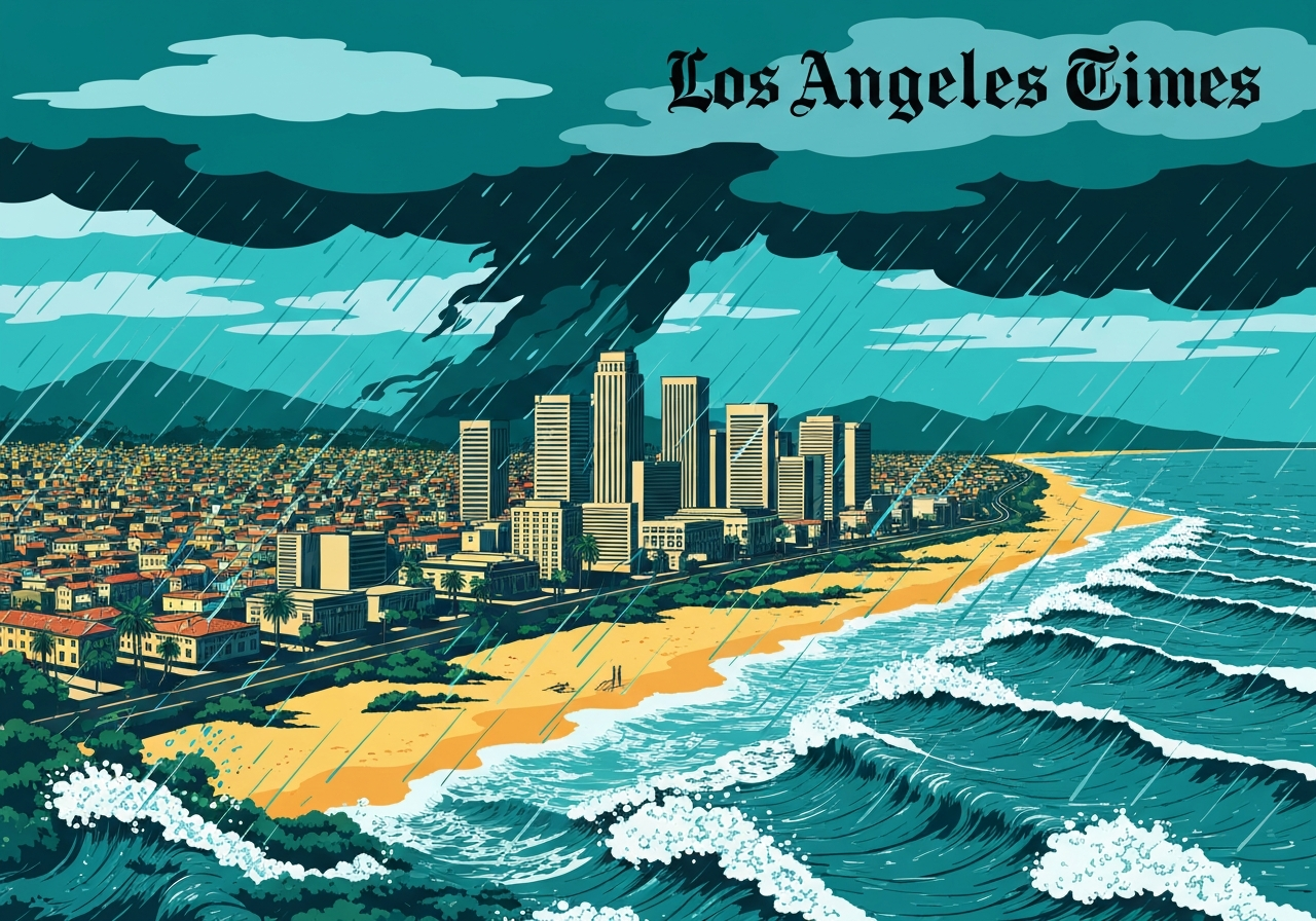
Lead: A strong Pacific storm is forecast to reach Los Angeles beginning Sunday, bringing thunderstorms, heavy rain, gusty winds and dangerous surf, with the most intense period expected late Sunday into Monday. Forecasts call for 1 to 2 inches of rain in coastal and valley areas Monday and roughly double that in the mountains, raising flood and mudflow concerns in recent burn-scar zones. Local authorities have issued evacuation warnings for parts of the Palisades and Eaton fire burn scars starting Sunday night, urging residents to prepare to leave if conditions worsen. The system will produce high surf and hazardous beach conditions across the coast and persist with on-and-off precipitation through the week.
- Strong system arrives late Sunday through Monday; heavy rainfall will persist into Monday and continue intermittently through Friday.
- Expect 1–2 inches of rain in coastal and valley areas Monday, with 2–4 inches likely in the mountains; snow levels mainly above 6,000 feet.
- High-surf threat: wave sets above 10 feet possible across Southern California beaches, with a 20%–30% chance of damaging sets developing Tuesday night–Wednesday night.
- Evacuation warnings issued Sunday night for large zones of the Palisades and Eaton fire burn scars by Los Angeles County Sheriff and L.A. Fire Department.
- Bay Area already under a beach hazard warning (Thursday night–Saturday morning) with breaking waves of 14–19 feet and rip-current risk.
- Gusts exceeding 40 mph are possible in Big Sur and higher terrain Sunday; slick roads could increase crash risk through midweek.
- Forecasters say the storm is unlikely to match the severity of last Christmas’ Pineapple Express, which set daily rainfall records across the region.
Background:
Southern California’s winter pattern often includes episodic Pacific storms that deliver coastal rain, mountain snow and elevated surf. Atmospheric rivers and strong southwesterly swells are primary drivers of the region’s heaviest winter impacts; when they align with existing offshore flows and frontal systems, rainfall and surf can intensify rapidly. Over the past decade, wildfire burn scars—areas with stripped vegetation—have become focal points for hazardous debris flows following even short, intense bursts of rain. Emergency managers now routinely link forecasts of brief heavy downpours with mudflow risks in those vulnerable drainages.
The recent memory of the Pineapple Express storm last Christmas remains fresh: that system produced record daily totals and triggered widespread flood watches and evacuation warnings in burn-scar neighborhoods. Local responders and the National Weather Service have emphasized early preparation since steep terrain and saturated soils increase the odds of rapid runoff and localized debris flows. Coastal communities also prepare for episodic high-surf events that can erode beaches, damage infrastructure and generate strong rip currents, compounding hazards for recreational users and responders alike.
Main Event:
Through Friday, Southern California will see a warm, dry interlude driven by an offshore flow, producing sunny skies across Los Angeles and environs. Temperatures dip slightly Saturday, then shift more markedly Sunday night as the approaching storm system digs into the region. The strongest period is forecast late Sunday through Monday, when meteorologists expect the heaviest precipitation and the greatest chance of thunder and gusty winds. Forecasters warn that even short bursts—15 minutes or so—of intense rain can trigger debris flows in recent burn-scar areas.
On Monday, coastal and valley locations are projected to receive at least 1 to 2 inches of rain, while mountain zones could see about twice that amount, with moderate snow accumulations at ski-resort elevations. Snow levels early in the event should remain above roughly 6,000 feet, though higher-elevation totals could be significant. After Monday and into Tuesday, forecasters anticipate heavy bursts, severe thunderstorms and damaging gusts in spots, followed by a temporary lull Tuesday night into Wednesday. The forecast then calls for precipitation to resume Wednesday night through Friday, maintaining the potential for intermittent heavy periods.
Local agencies acted ahead of the storm: on Saturday afternoon Los Angeles County Sheriff’s Department and Los Angeles Fire Department issued evacuation warnings for broad swaths of the Palisades and Eaton fire burn scars beginning Sunday night. Officials told residents in those zones to prepare for possible mud or debris flows and to be ready to evacuate if conditions deteriorate. Meanwhile, ocean forecasters have signaled a high likelihood of a high-surf advisory Monday–Thursday as a combination of southwesterly and west-northwesterly swells arrive along the coastline.
Analysis & Implications:
The storm’s timing and magnitude carry several near-term implications for public safety and infrastructure. Urban and valley flooding is the most immediate concern where drainage systems and roadways will contend with 1–2 inches of rain in short periods; this raises the risk of water-covered roads and traffic accidents. In the mountains, deeper totals and marginally cooler temperatures favor both rain and snow, increasing avalanche awareness at high elevations and straining mountain access routes. Burn-scar drainage channels remain the highest priority for debris-flow watches because vegetation loss allows rapid runoff and channelized flow of mud and debris.
Coastal impacts will be twofold: direct wave damage and secondary effects such as beach erosion and disruption to ports, marinas and coastal access. Wave sets above 10 feet across Southern California increase the danger of shoreline inundation and make rip currents deadly for unwary swimmers. The 20%–30% chance of damaging sets developing midweek is modest but material given the potential consequences to coastal infrastructure and public safety. Emergency services face heightened operational strain if they must support both inland flood rescues and coastal rescues simultaneously.
Economically, repeated storm surges and erosion can accelerate long-term costs for beach replenishment, seawall repairs and coastal road maintenance. For transportation, slick and flooded streets will likely produce more collisions and slow commutes, while mountain snow and gusts could affect chain requirements and freight routes. Forecast confidence is high that the region will receive at least moderate totals, but precise local impacts—such as which burn-scar channels might produce debris flows—depend on small-scale rainfall bursts that are harder to predict. Officials stress preparedness and local situational awareness as the most effective near-term mitigations.
| Region | Expected Monday Rain | Mountain Snow | Wave Heights |
|---|---|---|---|
| Coastal & Valley (SoCal) | 1–2 in | Minor above 6,000 ft | 10+ ft sets possible |
| Mountains | 2–4 in | Moderate accumulations at resort levels | NA |
| Bay Area Coast | Intermittent rain | NA | 14–19 ft breaking (Thu–Sat) |
The table summarizes forecast ranges issued by the National Weather Service and local offices. These are broad regional expectations; totals will vary considerably by drainage and elevation. Wave forecasts reflect ensemble guidance pointing to strong southwesterly and west-northwesterly swell energy arriving in stages. Forecasters emphasize that rapid, short-duration convection can locally increase hourly rainfall rates well above the regional averages shown here. Decision-makers use these ranges to issue targeted warnings and evacuation guidance where topography and burn scars increase vulnerability.
“The strongest portion of this system will arrive late Sunday into Monday, and we have high confidence in at least moderate rainfall across all areas,”
Ryan Kittell, NWS Oxnard
Ryan Kittell’s briefing framed the arrival window and the expected coverage of moderate rain totals, stressing timing as key for coordinating responses. His office has been coordinating with local emergency managers to monitor burn-scar channels and to time potential evacuation messages. That public messaging aims to reduce surprise and to give residents a clear window to prepare before conditions deteriorate.
“Even a 15-minute burst of heavy rain can trigger debris flow in recent burn scars,”
Carol Ciliderti, NWS Oxnard
Carol Ciliderti highlighted the nonlinearity of risk in burn-scar zones: short, intense bursts can produce outsized hazards compared with steady light rain. That concern underpins the evacuation warnings and is a common reason why authorities issue pre-emptive orders ahead of high-intensity convective bursts.
“Residents in affected burn-scar neighborhoods should prepare to leave if necessary,”
Los Angeles County Sheriff’s Department / L.A. Fire Department
Local public-safety agencies paired that operational guidance with maps and suggested evacuation routes, instructing residents to assemble critical items, move vehicles to higher ground and avoid low-lying roads. Those instructions are precautionary steps intended to reduce last-minute rescues when flows occur after dark or during peak runoff.
Unconfirmed:
- Specific times and locations of any mandatory evacuation orders beyond the announced warnings remain unconfirmed and depend on evolving conditions.
- Exact local debris-flow initiation points in individual drainages are not yet confirmed; small-scale convective bursts will determine where flows occur.
- Whether a formal high-surf advisory will be issued across all Southern California beaches Monday–Thursday has not been finalized as of this report.
Bottom Line:
This storm will produce measurable impacts across Southern California and parts of the Bay Area beginning Sunday night, with the most notable threats being urban flooding, debris flows in burn-scar areas and dangerous surf along the coast. Residents in advised zones should heed evacuation warnings, prepare emergency kits and avoid travel through flooded roadways. Coastal communities and beachgoers should monitor high-surf products and avoid exposed shorelines while rip currents and large breaking waves are possible.
Authorities and forecasters expect intermittent precipitation through the week, so the situation could evolve with renewed heavy periods later in the week. The best immediate actions are situational awareness, following official channels for evacuation notices, and taking precautions to protect life and property until the system passes.
Sources:
- Los Angeles Times — (news report)
- National Weather Service, Oxnard Office — (official forecast and statements)
- Los Angeles County Sheriff’s Department — (official public safety notices)
- Los Angeles Fire Department — (official evacuation guidance)