
Lead: On Dec. 5, 2024 a magnitude 7.0 earthquake struck offshore near the Mendocino Triple Junction, prompting a broad tsunami warning and renewed scrutiny of northern California’s offshore faults. Scientists who tracked persistent swarms of very small quakes—many near magnitude 0—used those signals to map previously hidden structures beneath the junction. Their new study, published in Science, reinterprets the junction as a multipart system with submerged fragments and invisible fault surfaces that may alter regional seismic risk. The findings point to fault interactions that could affect hazard assessments for both the San Andreas system and the Cascadia subduction zone.
Key Takeaways
- Researchers published a Science paper reporting that microearthquake swarms illuminated complex, three-dimensional fault geometry near the Mendocino Triple Junction.
- The team recorded thousands of tiny events—around magnitude 0—that reveal motion on faults invisible from the surface.
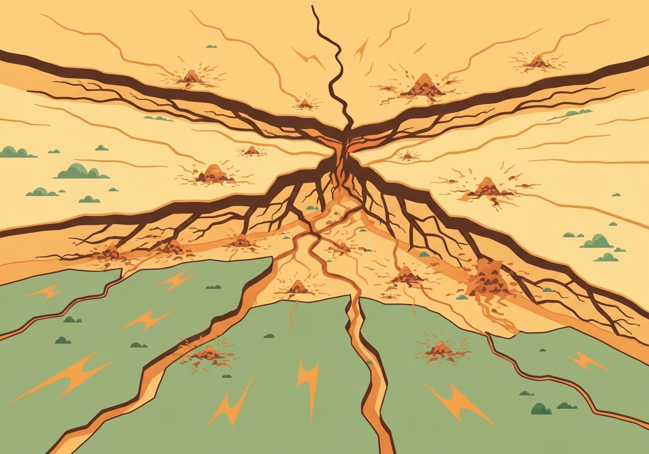
- Models divide the junction into five pieces; two blocks appear to move downward out of view, and one lost piece of the North American plate is now being pulled by the Gorda plate.
- The Pacific plate is transporting a buried rock body, the Pioneer fragment, northward beneath North America along a nearly horizontal, unseen boundary.
- The authors warn this geometry could represent an unaccounted seismic hazard, potentially changing probabilities for large earthquakes in the region.
- USGS records show five of California’s 11 earthquakes of magnitude 7.0 or larger since 1990 occurred near the junction; a M7.0 event on Dec. 5, 2024 struck southwest of Ferndale.
- Comparisons with recent inland swarms (for example, San Ramon) suggest different drivers: fluid-driven swarms inland versus long-term fault slip offshore.
Background
The Mendocino Triple Junction sits off the Humboldt County coast where the Pacific, North American and Gorda plates converge. That intersection marks a transition between the strike-slip San Andreas system and the Cascadia subduction zone, making it one of the most tectonically complex parts of the U.S. west coast. Historically, the region has produced several very large earthquakes; USGS data indicate that five of California’s 11 events ≥M7 since 1990 occurred near this junction.
Seismologists traditionally emphasize the largest, felt earthquakes to infer fault behavior, but continuous records also contain swarms of very small events that are usually overlooked. Advances in dense seismic networks and analysis methods now allow researchers to detect and locate thousands of microearthquakes, converting noise into information about slow or subtle fault motions. The new Science study applies these methods specifically to the Mendocino area, seeking to resolve structures that do not reach the surface.
Main Event
Following the Dec. 5, 2024 M7.0 offshore quake and its associated tsunami alert, researchers intensified scrutiny of the junction. Using long-term seismic records and high-resolution relocation techniques, the team mapped repeated tiny earthquakes and identified distinct clusters and alignments that trace faults at depth. These microevents are typically near magnitude 0—thousands of times smaller in energy than the M7 events—but they occur frequently enough to reveal patterns of slip.
The study’s preferred geometric model partitions the junction into five discrete blocks. Two of those blocks appear to be plunging beneath the surface, effectively moving out of view, while a fragment of the North American plate has been sheared off and is being drawn down by the Gorda plate. South of the junction, the Pacific plate carries the Pioneer fragment—a relic of an ancient plate—northward beneath North America along a subhorizontal fault that produces microseismicity but leaves little surface expression.
Authors argue that these submerged boundaries and transported fragments change regional stress transfer and connectivity among faults. That altered connectivity could influence how rupture might propagate between Cascadia and the San Andreas system, and it may change estimates of how and where strain accumulates before large earthquakes.
Analysis & Implications
Interpreting microearthquake swarms as indicators of long-term fault motion reframes hazard models that have relied primarily on surface-mapped faults and historical large events. If buried fragments like the Pioneer translate beneath the continent, they can modify the mechanical linkage between plate boundaries and change the effective length or orientation of rupture-prone surfaces. This matters because rupture propagation and stress interactions are sensitive to even modest geometric complexities.
One implication is that standard seismic-hazard maps, which depend on fault trace geometry and slip rates, may underestimate risk where hidden, partially detached blocks interact with major plate boundaries. The authors caution that the newly revealed structures could represent an unaccounted source of earthquakes or a conduit for stress transfer between Cascadia and faults farther south.
On a practical level, microquake-based monitoring offers a complementary tool for refining slip-rate estimates and locating active but blind structures. Where swarms reflect steady tectonic slip rather than transient processes, their frequency and distribution can be converted into quantitative constraints on fault motion—improving models used for seismic-hazard assessment and scenario planning.
Comparison & Data
| Metric | Near-Mendocino | Statewide (since 1990) |
|---|---|---|
| Notable M≥7 events near junction | 5 (of 11 statewide) | 11 total M≥7 events in California |
| Microearthquake magnitude | ~0 (study events) | Not routinely cataloged historically |
| Significant 2024 event | Dec. 5, 2024 — M7.0 (offshore) | N/A |
These simple comparisons show how microseismic catalogs can fill gaps left by conventional event lists. The study leverages dense microseismicity to identify features that would not appear in standard catalogs focused on felt earthquakes. Integrating these small-event datasets with geodetic and geological observations will be necessary to quantify how much hazard estimates change.
Reactions & Quotes
“The better that we understand how the plates are moving, the better job we can do to estimate seismic hazard.”
David Shelly, USGS research geophysicist and study lead
Context: Shelly emphasized that focusing on tiny, frequent events provides a different but complementary view to analyses centered on major earthquakes, enabling refined estimates of how faults slip over time.
“When you see the triple junction on a map, it all looks quite simple, with these three lines converging at a point, but in reality it’s more complicated three-dimensionally.”
Roland Burgmann, UC Berkeley seismologist (not involved in study)
Context: Burgmann praised the study for illuminating subsurface geometry, noting that the apparent simplicity of plate-boundary maps masks important depth-dependent complexities that affect rupture behavior.
“We could actually use the rate of earthquakes to understand variations and how fast that fault is moving.”
David Shelly, USGS
Context: The study suggests microquake rates can be translated into slip-rate information where events reflect steady tectonic motion rather than transient, fluid-driven processes.
Unconfirmed
- Whether the Pioneer fragment’s exact geometry and kinematics are uniquely resolved by the current model; alternative models may fit the data as well.
- The degree to which these hidden structures will change quantified earthquake probabilities for specific large-event scenarios remains to be established with integrated hazard models.
- Whether microquake rates can be universally translated into reliable slip-rate numbers for all buried faults without additional geodetic constraints.
Bottom Line
The Science study demonstrates that swarms of microearthquakes can expose previously hidden fault geometry beneath the Mendocino Triple Junction, revealing submerged blocks and an unseen horizontal boundary associated with the Pioneer fragment. These structural details complicate the classical map-view of the junction and suggest potential pathways for stress transfer between Cascadia and the San Andreas system.
While the findings do not prove imminent large earthquakes, they do identify previously unaccounted fault elements that could alter seismic-hazard calculations. Incorporating microseismic catalogs with geodetic measurements and geological mapping will be essential to translate these new observations into revised hazard assessments and preparedness planning.