
Lead
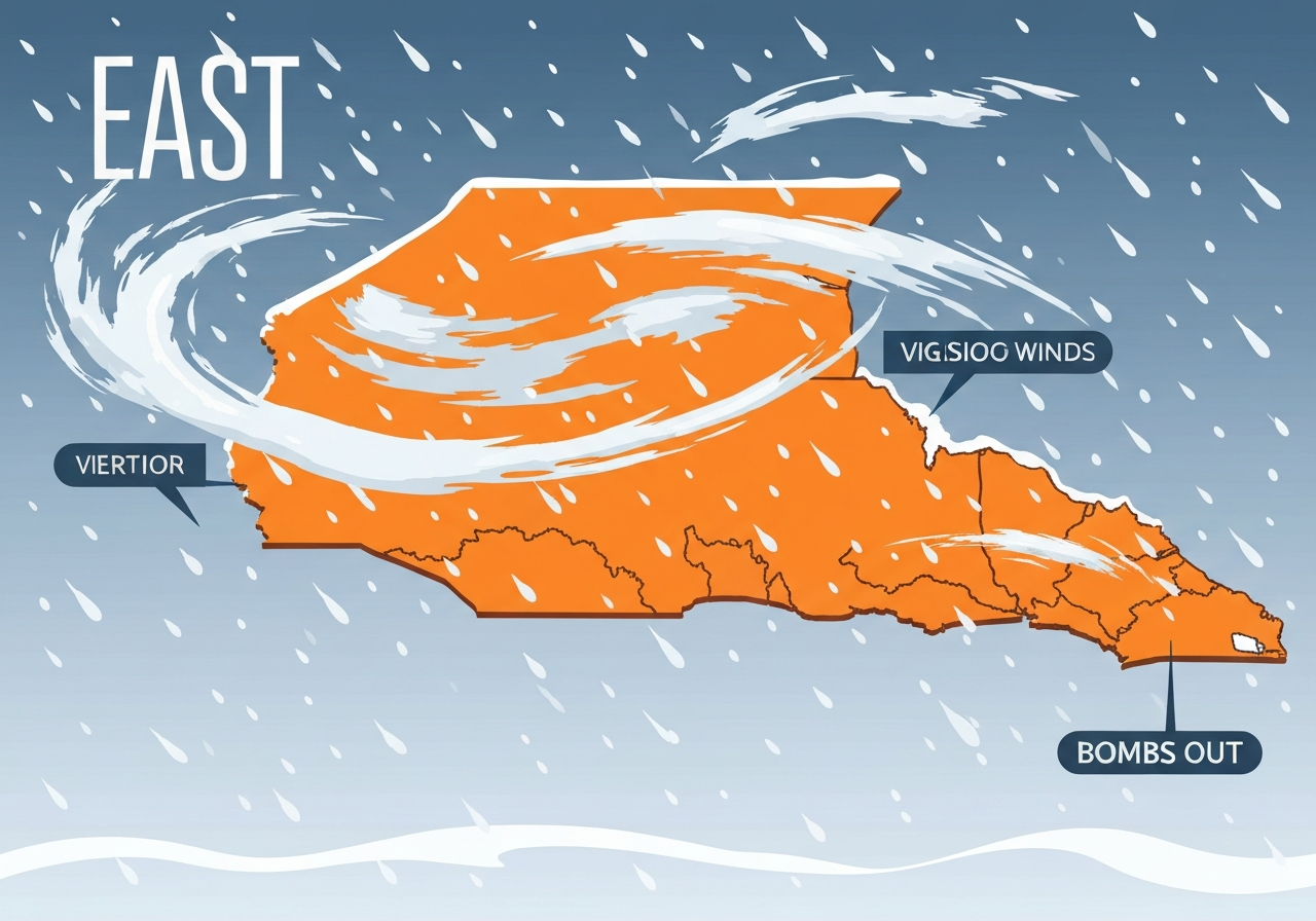
A rapidly intensifying nor’easter is undergoing bombogenesis off the Carolina coast, dropping roughly 35–40 millibars in 24 hours and strengthening into a dangerous “bomb cyclone.” The system is lashing the Southeast with hurricane‑force gusts—locally 60–80 mph—heavy, wind‑driven snow and major coastal flooding. Officials in North Carolina, South Carolina and Georgia have declared states of emergency while flight trackers show nationwide travel disruption. Coastal and inland communities face whiteout conditions, flooded shorelines and extended power outages as response operations continue.
Key Takeaways
- The storm has deepened about 35–40 millibars in 24 hours, a textbook case of bombogenesis centered off the Carolinas.
- Hurricane‑force gusts of 60–80 mph are possible along the coast; forecasters cite gusts up to 75 mph in some warnings.
- Heavy, wind‑driven snow could produce up to 12 inches in parts of the Carolina Piedmont and as much as a foot across vulnerable coastal plain and Outer Banks zones.
- Coastal Flood Warnings project 2–4 feet of inundation above ground level in low‑lying Outer Banks and Hatteras Island areas at high tide.
- Flight tracking services reported roughly 12,200 nationwide flight disruptions over the weekend as hubs including ATL, CLT and RDU faced widespread cancellations.
- PowerOutage.com data showed roughly 190,000 customers still without electricity in Mississippi, Tennessee and Louisiana following a prior ice event, compounding the humanitarian challenge as cold air returns.
- Charlotte recorded 6.0 inches at the airport on January 31, breaking the previous 1948 daily record of 0.9 inches.
Background
Nor’easters form when cold continental air collides with relatively warm Atlantic waters, creating strong onshore pressure gradients and heavy precipitation bands. This event intensified rapidly because a deepening coastal low drew abundant ocean moisture while an incoming Arctic lobe supplied anomalously cold air over the Southeast. Bombogenesis—defined conventionally as a pressure fall of at least 24 millibars in 24 hours—turns such systems into compact, high‑energy storms capable of producing hurricane‑force winds along exposed coasts.
The Southeast is comparatively unprepared for extreme winter coastal storms: major airports and ground crews there have limited winter‑weather infrastructure, so even modest snow and ice quickly degrade operations. Local utilities were still restoring customers after a historic mid‑Atlantic/Deep South ice event a week earlier, leaving tens of thousands vulnerable to the fresh Arctic plunge. State and local emergency managers moved preemptively to protect residents and prioritize clearance and shelter operations.
Main Event
This nor’easter bombed out off the Carolina coast late Saturday, with the center tracking eastward over the Atlantic even as the storm’s southern and western bands hammered the mainland. Outer coastal communities reported ocean overwash and roads inundated at high tide; the National Weather Service issued Coastal Flood Warnings for the Outer Banks and Hatteras Island calling for 2–4 feet of inundation in some low‑lying zones. Strong wind shear and tight pressure gradients produced gusts well into the 60–80 mph range on exposed capes and barrier islands.
Inland, convective snow bands have produced intense bursts—snow rates approaching 1 inch per hour in places such as the Carolina Piedmont and eastern North Carolina. Charlotte registered 6.0 inches at the airport on January 31, shattering the prior daily mark of 0.9 inches from 1948, and forecasters warned totals could reach 8–12 inches in localized sectors if bands persist. Visibility dropped to near whiteout conditions in portions of Greenville‑Spartanburg and eastern North Carolina, prompting road closures and multi‑vehicle incidents on interstates including I‑85 and I‑77.
Air travel was severely impacted: real‑time trackers showed thousands of cancellations and delays as airlines cut schedules at key hubs. Ground operations at airports such as Atlanta (ATL), Charlotte (CLT) and Raleigh‑Durham (RDU) slowed or paused due to heavy snow, icing risk and deicing/backlog issues. State DOTs and emergency services urged residents to remain home while plow and recovery operations focused on prioritized routes; officials noted plows can be sidelined if sustained winds exceed ~35 mph.
Analysis & Implications
Rapid deepening over relatively warm coastal waters intensified surface winds and injected ocean moisture into a cold air mass—conditions that favor heavy, wind‑blown snow and coastal flooding simultaneously. For the Southeast, the combination is particularly disruptive because infrastructure and operational procedures are optimized for infrequent events, magnifying impacts on travel, power and emergency response. The storm’s swift evolution also compressed the decision window for emergency managers, increasing the likelihood of cascading transportation and utility failures.
Civil readiness is being tested: utility crews are stretched thin from a prior ice storm that left roughly 190,000 customers offline in parts of Mississippi, Tennessee and Louisiana, and the return of extreme cold complicates restoration and sheltering. Agriculture faces acute exposure in Florida where extended freezes near or below 28°F threaten citrus and sensitive winter vegetables; forecasters warned of multiple nights of hard freeze conditions that could damage crops and storage facilities.
On the forecasting side, aircraft reconnaissance (an Air Force C‑130J mission) and higher‑resolution model runs are improving short‑range guidance, but fine‑scale placement of heavy bands can still swing totals neighborhood to neighborhood. That microscale variability means emergency messaging must emphasize localized hazards—whiteouts, drifting, flash flooding at high tide—rather than only regional climatologies.
Comparison & Data
| Metric | Reported/Forecast |
|---|---|
| Pressure fall | ~35–40 mb drop in 24 hours |
| Coastal wind gusts | 60–80 mph (hurricane‑force possible) |
| Snow (selected areas) | Charlotte: 6.0″ recorded; Piedmont pockets 8–12″ possible; coastal plain up to 12″ |
| Coastal inundation | 2–4 ft above ground level in Outer Banks/Hatteras at high tide |
| Flight disruptions | FlightAware and carrier reports: ~12,200 disrupted flights (weekend total) |
The table synthesizes key, measurable impacts reported by operational sources and trackers. Local variations will remain substantial: small shifts in storm track (on the order of 30–50 miles) already changed expected totals in New England, where a more easterly track reduced Cape Cod totals from a possible foot down to 1–3 inches in recent guidance.
Reactions & Quotes
“Folks, THIS is why we’re asking you to stay home.”
South Carolina Department of Public Safety (state agency post)
The state agency emphasized rising service calls for vehicles sliding off roads and urged residents across the Upstate, northern Midlands and Pee Dee to remain off the roads while crews work.
“The NWS will name tropical systems, but does not name winter storms unilaterally.”
National Weather Service (federal agency statement)
The NWS reiterated that winter storms are not officially named, noting different behaviors and impacts compared with tropical cyclones and stressing that official warnings contain the actionable guidance.
“We are flying reconnaissance to sample the atmosphere from top to bottom to improve forecasts.”
Air Force/Hurricane Hunter mission statement (official)
Forecasters and mission coordinators described the reconnaissance flight’s role in refining short‑range model output during rapid intensification phases.
Unconfirmed
- Exact nationwide flight disruption totals varied through the event; trackers and carrier tallies reported figures ranging from roughly 8,500 to 12,200 as conditions and cancellations evolved.
- Final localized snowfall totals remain uncertain in the Piedmont and coastal plain because heavy banding can cause large neighborhood‑level differences; official post‑storm surveys will refine totals.
Bottom Line
This nor’easter has combined rapid intensification, frigid continental air and warm ocean moisture to create an unusually aggressive coastal winter storm for the Southeast. The immediate threats are strong gusts, coastal flooding at high tide, blizzard‑like snow bands in exposed zones and major travel disruption—especially at airports with limited winter operations.
Emergency declarations, prepositioned shelters and travel waivers by major carriers reflect the operational strain; recovery will be complicated by preexisting power outages and the continuing Arctic cold. Residents in affected counties should heed local emergency guidance, avoid nonessential travel, prepare for sustained outages and expect incremental forecast changes as reconnaissance and model updates refine the storm’s evolution.
Sources
- FOX Weather (news outlet) — live coverage and forecasts
- FlightAware (flight tracking service) — operational disruption data
- PowerOutage.com (independent tracker) — utility outage tallies
- National Weather Service (federal agency) — warnings and technical statements
- NASA (federal agency) — Artemis mission notices and schedule updates