
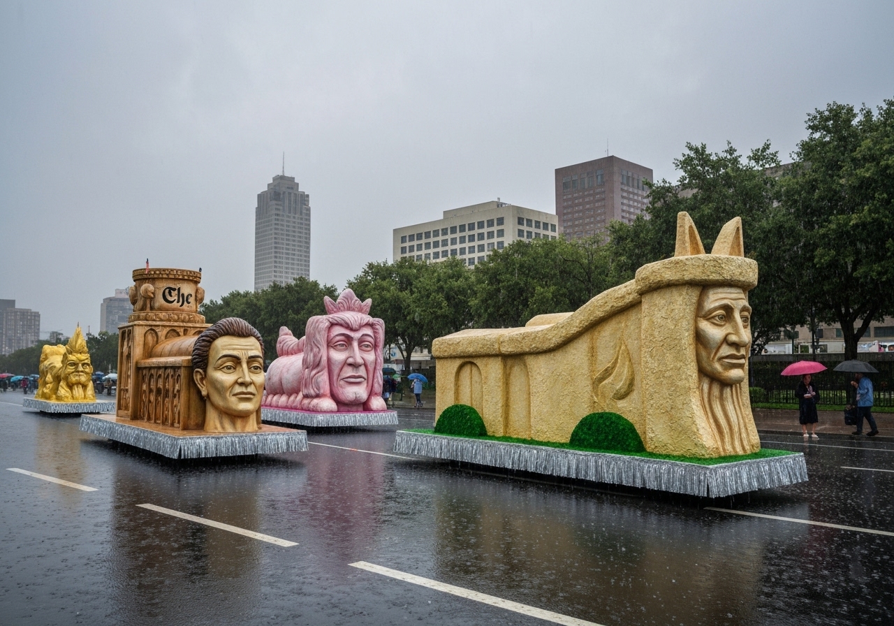
Organizers of the Rose Parade in Pasadena and regional emergency officials warned Wednesday that a strong winter storm is bringing near-certain rain to Southern California, threatening a wet New Year’s Day crowd along Colorado Boulevard. Forecasts called for rain beginning late Wednesday and continuing into Thursday morning, with a parade kickoff scheduled for 8 a.m. and thunderstorms possible through mid-morning. Officials said they are staging extra tow trucks, emergency crews and on-route personnel, and advising spectators to wear rain jackets or ponchos because umbrellas are not allowed. The situation echoes 2006, the last time the parade took place under wet conditions, when floats stalled and musicians struggled with saturated instruments.
- Forecasters with the National Weather Service’s Oxnard office put the chance of rain on the parade route near 100% for Wednesday night through Thursday morning.
- There is a 20%–30% probability of thunderstorms, with lightning risk and gusty winds of 10–25 mph and stronger gusts possible in storms.
- Rainfall totals are forecast at roughly 0.75–2.0 inches in coastal and valley areas, 2–5 inches in foothill and mountain communities, plus an additional ~0.5 inch on Friday.
- Emergency resources pre-positioned include seven swift-water rescue teams, three bulldozers, four hand crews, seven fire engines, two helicopters and one urban search-and-rescue company.
- Parade operations will include an on-site meteorologist, boots-on-the-ground personnel, additional tow trucks and distributed volunteers to manage weather-related incidents.
- Evacuation warnings and road closures were activated Wednesday at 11 a.m. in multiple fire-affected areas; Topanga Canyon Boulevard closures begin at 5 p.m. Wednesday.
Background
Southern California has been in a wet pattern since mid-December, with a Christmas-week deluge that caused fatalities, swift-water rescues and extensive mud and debris flows in mountain communities. Saturated soils from the earlier storms have left foothills and burned areas particularly vulnerable to new runoff, rockslides and mudslides when additional rain arrives. The state’s recent string of storms prompted pre-positioning of crews and equipment to high-risk zones, focusing on communities below recent burn scars and steep terrain.
Locally, the Rose Parade — an annual New Year’s Day event that draws tens of thousands of in-person spectators along Colorado Boulevard and many more via broadcast — has contingency plans rooted in lessons learned from the 2006 wet parade when several floats failed mechanically and performers contended with soaked gear. Pasadena officials said they train year-round for worst-case weather scenarios and will have a meteorologist on site Thursday to guide operational decisions in real time.
Main event
On Wednesday afternoon rain was already falling across parts of the Southland as the storm tracked in from the south and offshore Santa Ana winds eased. The National Weather Service’s Oxnard office advised that the bulk of precipitation should begin late Wednesday night and persist into Thursday morning, overlapping with the parade staging and kickoff period. Meteorologist Bryan Lewis told reporters that thunderstorms are possible overnight and into the morning, with lightning that could pose hazards to open grandstands and steel-framed parade floats.
Parade organizers said riders will have ponchos available, additional tow trucks will be staged along the route, and volunteers and public-address systems can move crowds quickly if conditions deteriorate. Organizers reiterated that umbrellas are prohibited because they block views; they urged attendees to use rain jackets or clear ponchos instead. Pasadena’s Emergency Operations Center activated Wednesday to coordinate response and liaise with county and state partners.
State and county emergency management also mobilized: Governor Gavin Newsom said crews were pre-positioned for flooding, mud and debris-flow response, and Los Angeles County’s Board of Supervisors ratified a local emergency proclamation to accelerate reimbursements and recovery. Police and fire agencies are contacting residents in especially vulnerable properties ahead of arrival of heavy rain and possible rapid runoff.
Analysis & Implications
The near-certain rain during a major outdoor event highlights the intersection of civic celebration and acute weather risk. High crowd density, elevated floats and open seating areas make the parade more sensitive to lightning and strong gusts; even absent lightning, heavy rain can cause float mechanics to fail, instruments to be damaged and marching bands to encounter safety issues. Logistics planners must balance public-safety prerogatives with the desire to hold the event, and their constrained options typically include temporary sheltering, route modifications, or in extreme cases suspension or delay.
Operationally, pre-staging tow trucks and assigning a parade meteorologist increase the speed of on-the-ground response and informed decision-making. The presence of seven swift-water rescue teams and other specialized assets improves readiness for urban flooding and debris-flow incidents, but response times can still be affected by clogged streets, downed trees and heavy traffic during a major event. For communities below burn scars, the combination of saturated soil and even moderate rainfall raises the probability of localized slides that can isolate neighborhoods and damage infrastructure.
Economically and socially, a wet parade can reduce in-person attendance and strain vendors and broadcasters; it also imposes cleanup and repair costs on municipal services. Conversely, proactive emergency declarations and resource pre-deployment can reduce harm and shorten recovery. Planners will be monitoring radar and field reports closely; if thunderstorms diminish by mid-morning as forecast, impacts to the parade may be limited to wet conditions and isolated float issues rather than a full operational suspension.
| Area | Forecast Rainfall |
|---|---|
| Coastal & valley | 0.75–2.0 in |
| Foothill & mountain | 2–5 in |
| Additional Friday | ~0.5 in |
This table places the expected totals in context: coastal and valley communities face modest but potentially disruptive rain, while foothills and mountains — already saturated in places — could see runoff that elevates landslide risk. Forecasted gusts of 10–25 mph, and stronger episodic gusts in thunderstorms, increase vulnerability for tall floats and exposed pedestrian areas.
Reactions & Quotes
Pasadena’s parade leadership emphasized preparation and on-site coordination as the primary mitigations for crowd and float safety. Officials described layered communication systems and trained volunteers ready to direct spectators as weather conditions evolve.
“Throughout the year, we train on worst-case scenarios and always hope for the best. Should we need to give direction to parade-goers due to extreme weather, we have boots-on-the-ground personnel and additional resources that can assist within minutes.”
Lisa Derderian, Pasadena spokesperson
The National Weather Service gave a technical forecast and safety guidance about thunderstorms, lightning and urban flooding, stressing the need to seek shelter and avoid exposed areas during lightning events.
“The bulk of the rain looks like it’s going to start late tonight and continue into tomorrow morning. There’s also a 20% to 30% chance of thunderstorms and potential lightning along the route.”
Bryan Lewis, National Weather Service (Oxnard)
State leaders highlighted pre-deployment of responders to speed rescue and recovery if conditions worsen, noting special attention to burn-scarred watersheds.
“We’re taking every precaution to keep people safe by pre-positioning emergency crews and activating resources in advance so we can respond faster if conditions deteriorate.”
Governor Gavin Newsom (statement)
Unconfirmed
- Precise parade-day attendance figures that would affect crowd density estimations remain unavailable until Thursday morning.
- Specific float-by-float vulnerability assessments have not been released publicly; organizer statements note general precautions without itemized risk ratings.
Bottom line
Southern California’s New Year’s Day Rose Parade is facing very high odds of rain with a non-negligible chance of thunderstorms and lightning that could create safety concerns for performers and spectators. Organizers and government agencies have pre-positioned resources and contingency measures to manage float failures, localized flooding and rapid evacuations if needed, and they are advising the public to use rain jackets or ponchos and avoid umbrellas on the route.
If thunderstorms remain short-lived and taper by mid-morning, the parade may proceed with largely manageable inconveniences; however, sustained heavy rain or lightning could force operational changes. Attendees should monitor official channels, follow instructions from on-site personnel, and sign up for emergency alerts such as NotifyLA.org for real-time updates.
Sources