
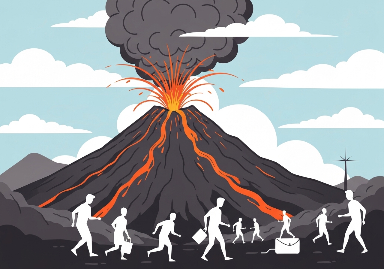
On , Mount Semeru in East Java erupted, sending hot ash and pyroclastic flows down its slopes and forcing local authorities to order evacuations. Indonesia’s Geology Agency reported ash and mixed hot material travelling as far as 7 km down the mountain several times through the afternoon and a hot cloud column rising about 2 km above the summit. Officials raised the volcano’s alert to the highest level after stepping up the danger zone to an 8 km radius, and more than 300 residents from three high-risk villages in Lumajang district were moved to shelters. No fatalities have been reported so far, while rescue teams worked to account for roughly 178 people reported at a mountain monitoring post overnight.
- The volcano produced pyroclastic flows and ash fall repeatedly on 19 November 2025, with hot material reported up to 7 km (4 miles) down slopes and an ash column about 2 km high.
- Authorities raised Semeru’s alert level twice during the day, moving it to the maximum alert and expanding the danger zone to 8 km (5 miles) from the crater.
- More than 300 residents from three villages in Lumajang district were evacuated to government shelters; officials advised avoiding the Besuk Kobokan river channel, a known lava and flow path.
- Local officials said about 178 people — including climbers, guides and porters — remained at the Ranu Kumbolo monitoring post overnight but were reported to be safe at the northern post 4.5 km from the crater.
- Semeru stands 3,676 metres tall and has a long history of eruptions; its December 2021 event killed 51 people and displaced more than 10,000 residents.
- Indonesia has 129 active volcanoes and sits on the Pacific “Ring of Fire,” exposing large populations to recurrent volcanic and seismic hazards.
Background
Semeru — also called Mahameru — is the highest peak on Java at 3,676 metres and has been intermittently active for centuries. Its slopes are fertile and densely settled, a common pattern across Indonesia where productive land coexists with volcanic risk. The island of Java is home to millions of people living within reach of active volcanic systems; past eruptions of Semeru, most recently in December 2021, demonstrated how rapidly pyroclastic flows and lahars can overwhelm villages and infrastructure. Indonesia’s disaster agencies and park authorities monitor Semeru closely, but variability in eruption style and weather conditions complicates forecasting and evacuation logistics.
Geologically, Semeru is part of the Sunda Arc and responds to subduction processes that drive frequent eruptions across the chain of Indonesian volcanoes. The national government, provincial authorities in East Java and the Bromo-Tengger-Semeru national park share responsibility for visitor management and emergency response at the mountain. Local economies rely on agriculture and tourism tied to the volcano and surrounding parks, creating tension between livelihoods and safety measures when alerts rise. Authorities maintain designated danger zones and monitoring posts such as Ranu Kumbolo to track climbers and visitors on the mountain.
Main Event
According to the Indonesian Geology Agency, Semeru emitted repeated hot avalanches and glowing material from midday into the evening on 19 November, producing dense ash curtains that settled on nearby communities. Observers reported the flows moving to the south-southeast on multiple occasions, while the agency recorded a hot cloud column approximately 2 km above the crater. Videos circulated on social media showing ash sweeping through forested valleys and across a river under a bridge, and residents were seen fleeing with faces covered in volcanic dust and rain.
Regional disaster agency BNPB spokesperson Abdul Muhari said teams evacuated more than 300 people from three villages judged most at risk within Lumajang district and relocated them to government shelters. He told reporters that the danger zone was widened to an 8 km radius after increased activity in the afternoon and that residents should avoid the Besuk Kobokan river channel, a known conduit for flows. Local park officials reported that about 178 people remained overnight at the Ranu Kumbolo monitoring post; the post lies roughly 4.5 km north of the crater and was not directly in the observed flow path to the south-southeast.
Bad weather, including rain and reduced visibility, complicated movement on the mountain and constrained rescue and relocation options. Park managers said the group at Ranu Kumbolo included climbers, porters, guides and tourism officials who had sheltered there when eruptions and conditions made descent dangerous. Emergency services established temporary shelter sites and distributed basic supplies, while authorities monitored ashfall and air quality for communities downwind. No casualties were confirmed in the immediate aftermath, and operations focused on continuous monitoring and ensuring at-risk residents were out of mapped hazard zones.
Analysis & Implications
The rapid escalation to the highest alert level underscores how quickly Semeru’s activity can intensify and the constraints authorities face when populated areas lie close to hazardous channels. Expanding the danger radius to 8 km is a risk-management decision intended to account for pyroclastic flows and secondary hazards such as lahars, which can follow riverbeds and travel far from the crater during and after eruptions. For residents living on fertile volcanic slopes, even modest eruptions can disrupt agriculture, commerce and transport for weeks or months, with implications for food supply and local incomes.
From a national preparedness perspective, Semeru’s 2025 activity tests coordination between geologists, park authorities, provincial disaster agencies and national response teams. Information flow — including rapid alerts about flow direction and ash distribution — is critical to avoid casualties and to prioritize rescue or shelter resources. The presence of climbers and tourism operators on the mountain highlights ongoing tensions between access to natural attractions and the need for stricter controls when monitoring indicates elevated risk.
Internationally, volcanic ash clouds pose aviation risks and can affect air traffic routing; while the 2 km column reported on 19 November is modest compared with some explosive eruptions, ash dispersal patterns depend on wind and can extend hazard footprints far from the vent. Economically, repeated disruptions at active volcanoes place recurrent strains on regional budgets for emergency housing, debris clearance and infrastructure repair. Long-term resilience will require investment in early warning systems, community preparedness and regulated land use around high-risk zones.
Comparison & Data
| Event | Year | Reported deaths | Evacuated or displaced | Notable metrics |
|---|---|---|---|---|
| Semeru major eruption | 2021 | 51 | >10,000 | Village burial by mud, mass burn injuries |
| Semeru activity | 2025-11-19 | 0 (reported) | 300+ evacuated | Flows up to 7 km; ash column ~2 km; danger zone 8 km |
The table highlights the different scales and outcomes. The 2021 eruption resulted in significant loss of life and large-scale displacement, prompting a large humanitarian response; the 2025 episode, while serious, had no confirmed deaths at the time of reporting and a much smaller evacuation footprint. Nonetheless, the physical behavior — pyroclastic flows, ash columns and flow along river channels — shows consistent hazards that can change rapidly depending on eruption intensity and weather.
Reactions & Quotes
BNPB and park officials described immediate response measures, sheltering and monitoring of visitors and residents.
“We have evacuated more than 300 residents from three villages and widened the danger zone to 8 kilometres to reduce exposure to flows and ash,”
Abdul Muhari, BNPB spokesperson (national disaster mitigation agency)
Park authorities clarified the condition of those sheltering at Ranu Kumbolo and stressed that the monitoring post was not directly in the observed flow path.
“The group at Ranu Kumbolo is currently safe; the post is located about 4.5 km from the crater on the northern slope,”
Endrip Wahyutama, TNBTS spokesperson (park authority)
A volcanologist contacted by regional media emphasized the need for caution and continuous monitoring as eruption behavior can shift without long warning.
“Semeru’s recurrent activity and the presence of river channels that funnel flows mean authorities must remain vigilant and keep communities out of mapped hazard corridors,”
Independent volcanologist (expert commentary)
Unconfirmed
- The precise status and number of people stranded at Ranu Kumbolo may change as rescue and tracking operations continue; early reports cited about 178 individuals but that figure was still being verified.
- The long-term extent of ash damage to crops, infrastructure and homes in affected villages remains under assessment and may evolve as ash and rain interact.
- Flight disruptions or wider regional air-quality impacts were not reported at the time but could emerge if ash dispersal shifts with changing winds.
Bottom Line
The 19 November 2025 eruption of Mount Semeru was significant enough to produce repeated pyroclastic flows and raise the alert to the highest level, prompting targeted evacuations and the temporary sheltering of several hundred residents. Rapid action to expand the danger zone and move people out of river channels likely reduced immediate casualties, though the situation remains fluid and sensitive to weather and subsequent activity.
For communities on fertile volcanic slopes, Semeru’s latest activity is another reminder of the trade-offs between livelihood and hazard exposure; resilience will depend on sustained monitoring, timely evacuations and investments in land-use planning that account for recurrent volcanic risk. Authorities and aid agencies will need to focus next on assessing ash damage, restoring essential services and supporting displaced households while keeping monitoring and communication lines open.
Sources
- The Guardian (news report)
- BNPB – Indonesia’s National Disaster Mitigation Agency (official agency)
- Indonesia Geological Agency (VSI) (official monitoring agency)
- Bromo-Tengger-Semeru National Park (TNBTS) (park authority)