
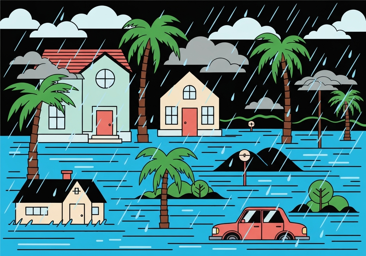
Lead: Over Christmas Eve and Christmas Day 2025, many parts of Southern California saw their rainiest holiday stretch in the modern record, according to the National Weather Service office in Oxnard. Mountain sites reported nearly 18 inches in multi-day totals, while widespread urban and foothill flooding forced closures, evacuations and at least five storm-related deaths. Governor Gavin Newsom declared a state of emergency for multiple counties to speed resources and repairs. The heavy precipitation marks one of the wettest starts to the water year (which began Oct. 1) and underscores a rapid swing from last year’s extreme dryness to this season’s intense rainfall.
Key Takeaways
- Several stations set Dec. 24–25 records: Santa Barbara Airport recorded 4.83 inches (prev. 3.22 in 1955); Woodland Hills 4.62 inches (prev. 3.34 in 1971); Oxnard 4.26 inches (prev. 2.00 in 1979).
- Downtown Los Angeles measured 2.59 inches over Christmas Eve–Day, the fourth-wettest two-day holiday period on record; the Dec. 24–25 record remains 3.82 inches from 1889.
- Mountain totals were far higher: Rose Valley exceeded 17 inches (three-day total), San Marcos Pass topped 14 inches, and Chilao South recorded more than 11 inches.
- Flood watches and evacuation orders were issued across the region, including dozens of homes in Sunland’s Riverwood neighborhood because of a planned partial release at Tujunga Dam.
- Storm-related fatalities included a motorist in Redding, a woman struck by a large wave in Mendocino County, a man killed by a falling tree in San Diego, and two people in a multi-vehicle crash on the Grapevine; authorities are still investigating causes.
- Impacts included washed-out roads, blocked bridges, swiftwater rescues, and prolonged freeway closures on sections of I-15 and I-5.
- The water year beginning Oct. 1 is already among the 10 wettest starts for Southern California through midday Christmas; this sharply contrasts with last year’s bone-dry conditions and extreme fire risk.
Background
Just one year earlier, officials were warning of an unusually dry winter; days later, gusts up to 100 mph and parched fuels contributed to the worst fires in Los Angeles history. The 2024 summer and fall produced some of the hottest months on record for coastal Southern California, and July 2024 became California’s hottest July on record. Those extremes left vegetation especially vulnerable and emergency planners focused on wildfire risk entering the 2024–25 season.
Climate scientists use the term “hydroclimate whiplash” to describe quick swings from drought to heavy precipitation; researchers have linked a higher frequency of such swings to human-caused warming, which alters atmospheric moisture and circulation patterns. The official water year, which runs from Oct. 1 to Sept. 30, is a standard hydrologic metric; strong early-season rain can improve reservoir levels but also raise short-term flood and debris-flow risks, particularly in recently burned watersheds.
Main Event
The storm system brought sustained periods of heavy rain from Wednesday into Friday, producing record two-day totals across multiple coastal and valley sites. The National Weather Service in Oxnard and in San Diego documented both the local records and larger mountain totals, with some slopes registering nearly 18 inches since Tuesday. Flood watches and localized flash-flood warnings remained in effect through Friday afternoon as runoff increased across urban channels and foothill drainages.
Mountain communities bore the brunt of fast-moving debris flows and mudslides. Wrightwood experienced a Christmas Eve debris flow that inundated streets and buried vehicles, with nearly 10 inches recorded in a 24-hour span. Lytle Creek residents were temporarily cut off after a key bridge was overtopped or damaged. Swiftwater and helicopter rescues were reported in multiple locations, and emergency crews worked through the holiday to reach isolated residents.
Transportation networks were disrupted: Interstate 15 through Cajon Pass and Interstate 5 in Sun Valley were shut for hours, and numerous local roads were impassable. Authorities issued evacuation warnings for neighborhoods in recent burn scars and for areas downstream of dams where controlled releases were planned to protect infrastructure. Forecasts called for snow in the San Bernardino high country—1–3 inches near 7,000 feet and 8–12 inches above 8,000 feet—and forecasters warned of a possible Santa Ana wind event early next week that could reintroduce fire weather concerns if drying occurs.
Analysis & Implications
In hydrologic terms, the immediate effect of the heavy rain was beneficial for drought metrics: soil moisture increased, reservoirs received inflows, and short-term wildfire fuel moisture improved. Officials noted that the precipitation helped pull parts of the state away from the most severe drought categories. However, sudden, intense rainfall also exacerbates hazard potential: saturated hillsides, particularly in areas scarred by recent wildfires, are highly susceptible to debris flows and landslides.
Infrastructure stress is another major concern. Southern California’s stormwater systems and older drainage channels were not designed for the concentrated rainfall rates observed during the storm, producing urban flooding and road damage. Emergency declarations and rapid deployment of state resources reflect both the immediate need for search-and-rescue and the larger fiscal impact of repairing roadways, culverts and flood-control structures.
From a climate perspective, this episode is consistent with projections that warming will increase atmospheric moisture while also increasing the frequency of extreme heat and drought spells. That combination drives more pronounced swings—drought followed by intense precipitation—that complicate long-term water management and hazard mitigation. Water managers and emergency planners will confront tradeoffs: capturing water where possible while safely managing fast-moving floods and preventing downstream damages from reservoir releases.
Comparison & Data
| Location | Dec. 24–25 Total | Previous Record (Year) |
|---|---|---|
| Santa Barbara Airport | 4.83 in | 3.22 in (1955) |
| Woodland Hills | 4.62 in | 3.34 in (1971) |
| Oxnard | 4.26 in | 2.00 in (1979) |
| Van Nuys | 4.12 in | 1.16 in (2019) |
| Rose Valley (mountains) | >17 in (3-day) | — |
The table highlights station-level records broken during the holiday storm and mountain totals that far exceeded coastal amounts. Mountain catchments concentrate orographic precipitation, producing the high totals that drove runoff and debris flows. These figures are compiled from National Weather Service station reports for the Oxnard and San Diego forecast offices and local flood-control observations.
Reactions & Quotes
“This is the rainiest Christmas in the modern record for many parts of Southern California,”
National Weather Service, Oxnard office
The NWS statement accompanied technical rainfall and flood warnings and was cited in multiple forecasts and briefings. Forecast offices emphasized continuing uncertainty about storm timing and amounts as the system exited the region.
“This is a standard process that has been conducted in the past,”
Los Angeles County Department of Public Works (on planned partial releases at Tujunga Dam)
County officials framed the controlled release as a preventative measure to avoid uncontrolled overtopping; deputies and emergency managers issued evacuation orders and warnings to nearby residents as a precaution.
“We are mobilizing state resources to respond and help communities recover,”
Governor’s office (state of emergency declaration)
The governor’s emergency declaration authorized rapid deployment of Caltrans and state teams to clear roads and seek federal repair assistance where needed.
Unconfirmed
- Authorities have not publicly disclosed a definitive cause for the multi-vehicle crash on the Grapevine that killed two people; investigations are ongoing.
- Forecast models diverge on the timing and magnitude of any return precipitation around New Year’s Day; specific totals for late-week precipitation remain uncertain.
Bottom Line
The Christmas 2025 storms delivered record rainfall across many Southern California stations, dramatically altering short-term drought conditions but also producing hazardous flooding, debris flows and infrastructure damage. The event highlights the dual nature of extreme precipitation in a warming climate: it can relieve prolonged dryness yet increase acute hazards where landscapes and infrastructure are vulnerable.
Looking ahead, emergency managers, water agencies and communities will need to balance immediate recovery—clearing roads, repairing levees and supporting evacuees—with longer-term changes in planning and design that anticipate more frequent drought-to-deluge swings. Key near-term items to watch are reservoir management decisions, the impact of any Santa Ana winds, and official updates on ongoing investigations into storm-related fatalities and major transportation incidents.
Sources
- Los Angeles Times — news report summarizing regional impacts and local reporting.
- National Weather Service, Oxnard office — official forecasts and station rainfall reports (official).
- National Weather Service, San Diego office — regional forecast and warnings (official).
- Los Angeles County Department of Public Works — statements on dam operations and local flood mitigation (official).