
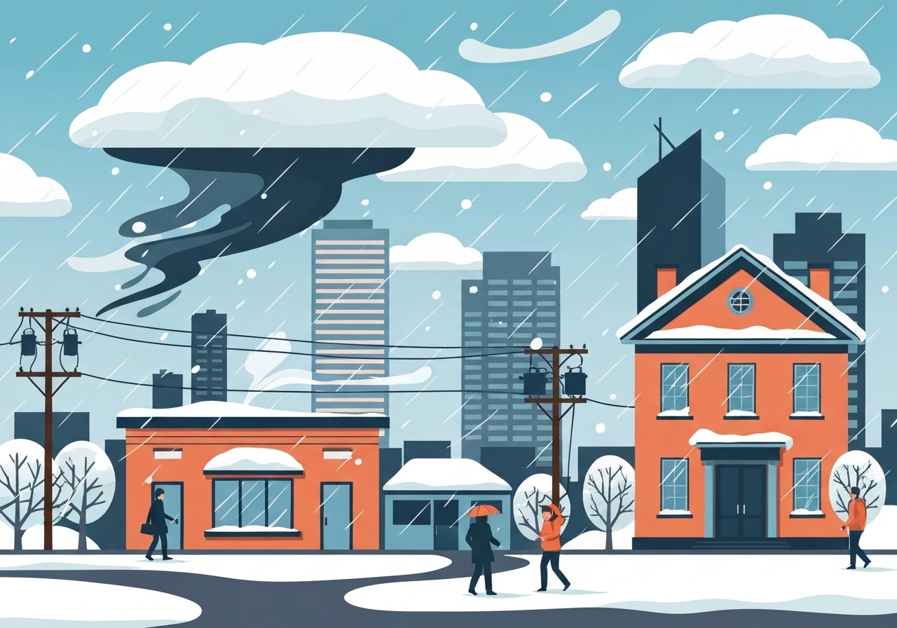
Who: Residents of the Piedmont Triad, N.C.; When: this coming weekend into early next week; Where: across the Triad and nearby counties; What: a winter storm that will begin as snow Saturday morning and may change to sleet or freezing rain Saturday night into Sunday; Result: widespread hazardous travel, possible power outages, and a period of bitter cold into next week.
Key Takeaways
- Snow begins Saturday morning with precipitation chances around 80% for the region and continues into the early evening.
- Precipitation is expected to transition to a wintry mix Saturday night into Sunday, but the exact timing of changeover is uncertain for individual communities.
- Weekend daytime highs are forecast near the mid-20s with overnight lows in the teens, increasing the risk of ice where freezing rain or sleet occurs.
- Earlier this week a sequence of three cold fronts will pass: the first arrives overnight tonight, a second Thursday night, and the third sets up the colder pattern for the weekend.
- Friday has a low, roughly 20% chance of light showers as the second front stalls to the south; highs will return to the upper-40s that day.
- Bitter cold persists into early next week: Monday highs in the upper-20s and possible moderation to about 32°F by Tuesday, while morning lows drop into the mid-teens and single digits.
- Officials warn to prepare for significant impacts, including hazardous travel and the potential for power outages that would heighten cold-related risk.
Background
The Piedmont Triad is entering a multi-front pattern that will push colder air into central North Carolina. Meteorologists note this is the first of three cold fronts to affect the region in quick succession, which has set up an unusually amplified temperature swing over the span of a few days. This late-winter-like sequence follows a relatively mild period earlier in the week, when highs climbed into the upper-40s and then into the upper-50s Thursday afternoon in some spots. The rapid change from unseasonably warm to well-below-freezing conditions increases uncertainty about precipitation phase—snow, sleet, or freezing rain—because small variations in temperature profiles will determine outcomes at the surface.
Local governments, school systems and public works agencies typically prepare for these mixed events because sleet and freezing rain can quickly degrade road conditions and damage power lines. Past Triad winter events have shown that sleet atop snow reduces measurable accumulations while producing a harder, more hazardous surface for vehicles and pedestrians. Emergency managers emphasize checks on heating, insulation, and generator readiness ahead of predictable power strain during cold snaps. Forecast offices monitor model runs closely as the event approaches; details will be adjusted in successive updates.
Main Event
Today begins with sunshine, turning partly cloudy late; highs will rebound to the upper-40s before a cold front—the first of three—moves through overnight, lowering temperatures to the mid-30s. Thursday will be the mildest day of the stretch with increasing sunshine and unseasonably warm highs reaching the upper-50s by afternoon. The second front arrives Thursday night and ushers in cooler air for Friday, bringing highs back to the upper-40s and a modest 20% chance of showers as the boundary stalls to the south.
By Saturday morning, precipitation is forecast to begin as snow across the Triad area and is likely to continue into the early evening; forecast guidance currently places the precipitation probability near 80% Saturday. Temperatures through Saturday and Sunday are expected to remain cold, with daytime highs around the mid-20s and overnight lows in the teens, creating an environment conducive to freezing rain or sleet where warm layers aloft mix with surface sub-freezing air. Forecast models diverge on the timing of the thermal profile change, so the onset of sleet or freezing rain versus all-snow will vary by location.
Any transition to sleet or freezing rain on top of an initial snowpack would produce particularly hazardous road surfaces and could limit measured snow depth because sleet compacts and freezing rain forms glaze. Local travel impacts will likely peak during the changeover window—Saturday night into Sunday—when surface temperatures and precipitation intensity interact. If precipitation persists while cold air is entrenched, power infrastructure may be stressed by ice accumulation and fallen tree limbs, raising the likelihood of outages in vulnerable neighborhoods.
Analysis & Implications
The immediate implication is that communities must prepare for multi-hazard impacts: heavy, wet snow in some locations; compacting sleet in others; and freezing rain that creates ice on roadways and power lines. Economically, hazardous travel and potential power disruptions could affect retail operations, healthcare access, school schedules, and supply chains across the Triad for at least a day or two. Municipal crews will face a challenging mission: treating roads is more difficult when precipitation changes phase mid-event, and de-icing chemicals perform differently on sleet-and-ice surfaces than on fresh snow.
Public-safety planning should prioritize warming centers, continuity for medical and social services, and targeted outreach to households dependent on electric heating or medical devices. The combination of an evolving storm and subsequent bitter cold increases the stakes of any outage—without power, indoor temperatures can fall rapidly and create hypothermia risk, especially for elderly residents and those without alternate heat sources. Agencies often advise charging essential devices, securing fuel supplies for generators, and reviewing family emergency plans ahead of the event.
For transportation, even modest sleet layers can cause major slowdowns and crashes; layered snow-sleet events typically produce longer recovery times than a simple, dry snow because of compaction and refreezing. Travelers should assume reduced mobility Saturday into Sunday and plan to avoid nonessential trips during the highest-impact window. Utilities and road crews will determine restoration timelines based on ice load and access; residents should expect updates as crews assess conditions once precipitation ends.
Comparison & Data
| Period | Highs (°F) | Lows (°F) | Precip Chance |
|---|---|---|---|
| Today | Upper 40s | Mid 30s | Low |
| Thursday | Upper 50s | — | Low |
| Friday | Upper 40s | — | ~20% |
| Saturday–Sunday | Mid 20s | Teens | ~80% (Sat) |
| Monday–Tuesday | Upper 20s → ~32 (Tue) | Mid-teens / single digits | Low |
The table summarizes the primary numerical elements of the forecast: a warm midweek that gives way to a high-impact wintry period Saturday into Sunday, followed by a cold start to the next week. These values reflect current guidance and are subject to adjustment as new model runs arrive; the precipitation-phase uncertainty (snow vs. sleet/freezing rain) is the dominant variable affecting local impacts and accumulated snow totals. Decision-makers should track updates through Friday and Saturday morning when the timing of the cold-air intrusion becomes clearer.
Reactions & Quotes
Local meteorologists and emergency officials are urging residents to prepare while details are refined. Forecast offices emphasize that small temperature differences will change outcomes and that preparations should assume the worst reasonable scenario for safety.
Plan as if travel will be dangerous and outages possible; secure heat sources and limit road travel during the storm window.
WGHP / Local meteorology office
State-level forecasters note the risk of an ice transition that would create hazardous conditions even where snow accumulates first.
Heavy snow changing to sleet or freezing rain can create long-lasting hazardous surfaces and increase the risk of power interruptions.
National Weather Service — Raleigh (official forecast)
Emergency management officials remind residents to check on neighbors and review household plans for sustained cold or power loss.
Residents should verify heat plans, have emergency supplies ready, and follow local guidance for public warming centers if needed.
Local emergency management (official)
Unconfirmed
- The precise timing and location of the changeover from snow to sleet or freezing rain remain uncertain for individual communities.
- Exact snowfall totals and ice accumulation amounts are not yet reliable; ranges will be refined in subsequent forecasts.
- The geographic extent and duration of any power outages cannot be determined until after the event and depend on ice loading and storm intensity.
Bottom Line
The Piedmont Triad should prepare now for a weekend storm that is likely to begin as snow Saturday morning, with high chances of precipitation and a probable transition to sleet or freezing rain Saturday night into Sunday. This evolution creates a high potential for travel disruption, dangerous road conditions, and possible power outages—impacts that will be magnified by the cold air locked in for early next week.
Residents and organizations should finalize preparations: secure emergency supplies, confirm heating and communication plans, and avoid nonessential travel during the peak impact window. Monitor authoritative updates from local forecast offices and emergency managers; forecasts will be refined as model guidance converges and observations clarify the thermal profile.
Sources
- WGHP / MyFox8 — local news forecast (local media)
- National Weather Service — Raleigh/WFO (official forecast office)