
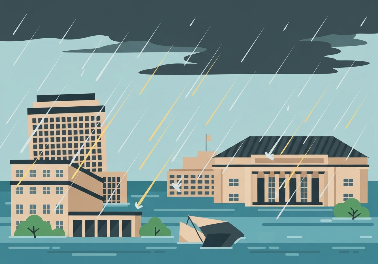
— A persistent atmospheric river stalled over the Pacific Northwest on Wednesday, unleashing intense rainfall that sent rivers in Western Washington toward historic highs and prompted evacuation preparations across multiple counties. Tens of thousands of residents along the Skagit, Snohomish and Puyallup river corridors were told to prepare to leave as flood warnings expanded and local officials warned of rapidly rising waterways. The storm also produced localized flash flooding — notably the Wallace River’s inundation of Gold Bar — and led Gov. Bob Ferguson to declare a state emergency and request federal support. Forecasters and river experts cautioned that some rivers could reach record levels in the coming days, raising the prospect of extensive property damage and long evacuations.
Key takeaways
- Forecasters on Dec. 10, 2025, warned of the potential for “catastrophic flooding” across parts of Western Washington as an atmospheric river stalled over the region.
- Tens of thousands of people in low-lying areas along the Skagit, Snohomish and Puyallup Rivers were put on alert or told to be ready to evacuate.
- Gov. Bob Ferguson signed a state emergency declaration on Dec. 10 and indicated federal assistance would likely be necessary to protect lives and homes.
- The Wallace River overflowed in Gold Bar on Wednesday, contributing to road closures and localized emergency responses.
- NOAA satellite imagery (GOES-18) and Northwest River Forecast Center guidance were cited in expanded flood warnings and forecasts of record river stages.
- Flood categories (minor, moderate, major) were used regionwide to prioritize evacuations and road closures; some communities faced the risk of major flooding with significant inundation.
- The storm system extended into British Columbia, amplifying regional river flows and complicating cross-border emergency coordination.
Background
Atmospheric rivers — narrow corridors of concentrated moisture transported by the atmosphere — can deliver prolonged, intense rainfall when they stall or repeatedly feed a region. The Pacific Northwest is climatologically susceptible to these events in late autumn and winter, but the current system brought unusually persistent precipitation beginning Monday and continuing through Wednesday, 10 December 2025. Rivers draining the western slopes of the Cascade Range, including the Skagit and Snohomish, collect runoff from steep, forested terrain, which can translate heavy rainfall into rapid rises in river stages.
Past events provide context: severe flood episodes in the region have in previous decades produced extensive damage and long recovery periods, prompting improved forecasting and evacuation planning. The Northwest River Forecast Center and local emergency managers use stage forecasts, real-time gage data and precipitation totals to issue graduated warnings. Stakeholders — state and county emergency offices, tribal governments, municipalities and transportation agencies — coordinated alerts as the storm evolved, but residents in floodplains still faced compressed decision windows to evacuate or safeguard property.
Main event
By Wednesday the storm’s persistent moisture plume produced heavy rain across Puget Sound and adjacent foothills, prompting the National Weather Service and local offices to expand flood warnings. Forecasters specifically cautioned that some streams and rivers could crest at or above previously recorded highs in the coming 48–72 hours. As a result, evacuation advisories and orders were issued for select neighborhoods along the Puyallup River southeast of Tacoma and for vulnerable stretches of the Skagit and Snohomish basins.
Gold Bar, northeast of Seattle, experienced significant flooding when the Wallace River overtopped in places on Wednesday, leading to submerged streets and isolated homes. Emergency responders worked to close impacted roads and to provide situational reports to county incident commands. In many communities, sandbag distribution centers and sheltering options were activated, while some residents moved to higher ground preemptively.
Gov. Bob Ferguson’s emergency declaration aimed to mobilize state resources and to position a federal assistance request, acknowledging the expected scale of impacts. Local public works crews, sheriff’s offices and volunteer organizations were deployed to support evacuations, perform swift-water rescues if needed, and to assess infrastructure vulnerability including bridges and critical roadways. Satellite imagery from GOES-18 and river-forecast model outputs were central to operational briefings and public messaging.
Analysis & implications
The immediate consequence is heightened risk to life and property in low-lying communities and along river corridors that funnel runoff from the Cascades. When rivers approach record stages, inundation patterns can exceed modeled footprints because of debris jams, levee overtopping or channel changes after prior storms. That raises both short-term rescue challenges and longer-term recovery costs for homeowners and public infrastructure.
Economically, repeated atmospheric-river events can strain municipal budgets through emergency response costs, road repairs and debris removal. If federal disaster aid is approved, it will offset only a portion of cumulative losses, and the timeline for rebuilding can extend months to years depending on damage severity. Insurance gaps remain a concern for many residents in floodplains who may lack flood-specific coverage.
Politically and administratively, the storm tests cross-jurisdictional coordination among counties, tribal governments and state agencies — and the speed of federal assistance decisions. Successful evacuations and timely resource staging depend on accurate, transparent forecasts and clear public communication; failures in any link can produce preventable harm. Longer term, recurring high-impact storms are likely to push policy debates on land use, floodplain management and infrastructure investment in Washington state.
Comparison & data
| Flood Category | Typical consequences |
|---|---|
| Minor | Minimal property damage; localized road closures |
| Moderate | Inundation of structures and roads; some evacuations |
| Major | Extensive inundation; significant evacuations and infrastructure damage |
These qualitative categories guided authorities as forecasts projected river rises. Satellite-derived water-vapor imagery from GOES-18 (NOAA) confirmed a concentrated moisture plume, and the Northwest River Forecast Center issued stage forecasts that drove local evacuation planning. Because exact crest heights vary by gage and watershed, responders prioritized areas mapped historically as most vulnerable.
Reactions & quotes
“I’m very concerned.”
Steve King, Hydrologist, Northwest River Forecast Center (official)
King’s remark summed up river forecasters’ assessments on Dec. 10, reflecting model runs and real-time gage trends that showed rapid rises in some basins.
“Follow evacuation orders when they are issued.”
Gov. Bob Ferguson (state official)
Ferguson signed a state emergency declaration to free state resources and to prepare a possible federal aid request aimed at protecting lives and homes.
“There is potential for catastrophic flooding in parts of Western Washington.”
National Weather Service / NOAA (official forecast)
The NWS phrasing defined the upper-bound scenario and was used in public warnings to communicate urgency to communities at risk.
Unconfirmed
- Exact timing and heights of river crests for every affected gage remain projections and can change as new rainfall data arrive; some reports of record crests are pending final gage verification.
- Initial damage reports from smaller communities are still being collected; full accounting of property losses and infrastructure damage has not yet been compiled.
Bottom line
Western Washington faced a high-risk flood event on Dec. 10, 2025, driven by a stalled atmospheric river that delivered sustained heavy rain and pushed several rivers toward potentially record stages. Authorities prioritized evacuations and emergency resources in known vulnerable corridors — notably along the Skagit, Snohomish and Puyallup Rivers — while federal aid was being sought to supplement state response.
For residents in threatened flood zones, the immediate priority is heeding evacuation orders and moving to designated shelters or higher ground; for planners and elected officials, the storm underscores long-term imperatives on floodplain management, infrastructure resilience and insurance coverage. In the days ahead, validated gage readings and post-storm assessments will determine the full scale of impacts and the scope of recovery needs.
Sources
- The New York Times — (news report)
- Northwest River Forecast Center — (official river forecasts, NOAA)
- National Oceanic and Atmospheric Administration / NWS — (official forecasts and GOES-18 imagery)
- Office of the Governor of Washington — (state emergency declaration information)