
Lead
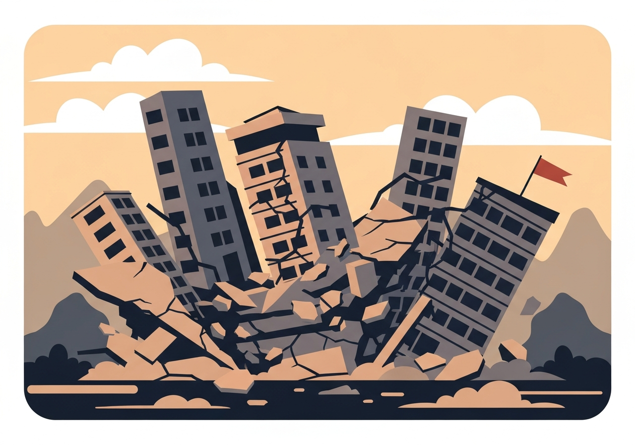
A powerful magnitude 7.8 earthquake struck off the coast of Mindanao shortly before 7:40 a.m. local time on Monday, 8 June 2026 (23:40 GMT, Sunday), killing at least 15 people and damaging buildings in southern Mindanao. The tremor, followed by more than an hour of aftershocks recorded by PHIVOLCS, caused severe damage in General Santos City and prompted tsunami alerts across parts of Asia before most warnings were later cancelled. Emergency agencies were mobilised, schools were ordered closed in affected areas and search-and-rescue operations began amid concerns over collapsing structures and disrupted services. Authorities say tsunami risk has largely receded, though advisories remained in place for parts of Japan at the time of reporting.
Key Takeaways
- Magnitude: The United States Geological Survey recorded the main shock as magnitude 7.8, striking off southern Mindanao on 8 June 2026 at 07:40 local time (23:40 GMT, 7 June).
- Casualties: At least 15 deaths have been reported and dozens of injuries are under assessment, with figures expected to change as crews reach damaged areas.
- Urban impact: General Santos, a city of about 722,000 residents, sustained some of the heaviest damage, including collapsed commercial buildings and structural failures at medical facilities.
- Education disruption: President Ferdinand Marcos Jr ordered school closures in affected zones; PNA reported roughly 3.2 million students and 128,000 teachers and staff were impacted on the nation’s opening day.
- Tsunami alerts: Authorities across the Philippines and Indonesia issued tsunami warnings that were later cancelled; a limited advisory remained for Japan’s southern coast and outlying islands.
- Aftershocks: PHIVOLCS recorded more than an hour of strong aftershocks following the main quake, increasing concern about additional collapses and ground instability.
- Critical infrastructure: Parts of St. Elizabeth Hospital in General Santos were reported severely damaged, forcing medical staff to move patients outdoors and to temporary facilities.
Background
The Philippines sits along the Pacific “Ring of Fire,” where the interaction of the Philippine Sea Plate and the Eurasian Plate produces frequent seismicity and volcanic activity. Large earthquakes and tsunamis have a long history in the archipelago; governments and communities maintain permanent disaster-response institutions because of the recurring risk. PHIVOLCS (the Philippine Institute of Volcanology and Seismology) monitors seismic activity and issues intensity reports that supplement magnitude readings from global agencies such as the USGS.
Mindanao and the southern island provinces have experienced damaging earthquakes in past decades, prompting ongoing debates about building codes, retrofitting of public infrastructure and early-warning systems. Urban growth in cities like General Santos has increased the number of people and assets exposed to seismic hazards. National and local disaster-response agencies, including the Office of Civil Defence and the National Disaster Risk Reduction and Management Council, run regular drills and maintain contingency plans, but major events still test readiness and logistics.
Main Event
The 7.8 shock hit offshore near southern Mindanao at 07:40 local time on 8 June 2026; residents reported intense shaking that sent people into the streets and triggered chaotic traffic. PHIVOLCS said the event registered as “very strong” on its internal intensity scale in parts of Soccsksargen, the region that includes General Santos. Video posted to official social channels showed a three‑storey building housing a Jollibee restaurant collapsing into a cloud of dust, while other footage documented shattered windows and caved roofs across commercial and residential structures.
In General Santos, police and local officials reported extensive structural damage and disruptions to hospitals. Robert Dagun, a police spokesperson, said parts of St. Elizabeth Hospital were critically impaired, requiring evacuation of patients and temporary outdoor operations by medical teams. Notre Dame of Dadiangas University faculty described partial collapses in campus buildings and panicked road traffic as drivers struggled to control vehicles during intense shaking.
The initial quake produced many aftershocks over the following hour, according to PHIVOLCS, complicating rescue access and assessments. Local crews and national emergency teams mobilised search-and-rescue operations, while residents in coastal and low-lying areas were urged to move to higher ground until tsunami risk assessments were completed. Across the region, early tsunami warnings prompted temporary coastal evacuations before most alerts were rescinded as additional data indicated limited sea-level changes.
Analysis & Implications
The immediate human cost — deaths, injuries and displaced people — will be the primary metric for response agencies, but the economic and social ripple effects can be prolonged. General Santos is a regional commercial hub; damage to schools, hospitals and businesses will disrupt services and livelihoods and could strain local budgets for reconstruction. The closure of schools affecting 3.2 million students underscores the wider societal impact of a single major quake in a densely populated archipelago with a centralised school calendar.
Structurally, the collapse of multistorey commercial buildings raises questions about compliance with seismic building codes and the resilience of mid‑rise construction. Investigations will likely focus on design, materials and retrofitting priorities, particularly for public facilities such as hospitals and schools that must remain operational in disasters. Past events show that effective retrofitting and enforcement can greatly reduce casualties, but implementation remains uneven across regions.
Regionally, the event underlines enduring tsunami vulnerability across Southeast and East Asia. Rapid cancellation of most tsunami warnings reflects improved monitoring and communications, but the persisting advisory for parts of Japan shows how far-reaching offshore seismic events can produce complex, time‑staggered hazard profiles. International coordination on alerts and clear local evacuation protocols remain critical to limit loss of life during trans‑boundary tsunami threats.
Comparison & Data
| Event | Year | Magnitude | Reported Fatalities |
|---|---|---|---|
| This Mindanao quake | 2026 | 7.8 | At least 15 (initial) |
| Moro Gulf quake | 1976 | 7.9 | ~8,000 (tsunami) |
| Bohol quake | 2013 | 7.2 | ~222 |
The table places the 2026 event in historical context: its magnitude is comparable to past destructive quakes in the Philippines, though immediate reported fatalities are lower than some historic disasters that also generated tsunamis. Historical comparisons highlight the role of secondary hazards (especially tsunami) and the importance of rapid warning systems, evacuation capacity and resilient infrastructure to reduce casualties and economic loss.
Reactions & Quotes
Officials and community members spoke publicly as emergency measures were put in place and rescue efforts began.
“Emergency agencies have been activated and I have ordered schools closed in affected areas — the safety of our children comes first.”
President Ferdinand Marcos Jr (official statement)
Marcos’s order reflected immediate protective measures affecting millions of students and staff during the nation’s school opening day, underscoring the quake’s wide societal impact beyond the directly damaged zones.
“We experienced a very strong event in parts of Soccsksargen, followed by numerous aftershocks; assessment teams are en route to the hardest-hit areas.”
PHIVOLCS (seismological agency)
PHIVOLCS emphasised ongoing monitoring and the need for local authorities to stabilise search-and-rescue operations amid continuing seismic activity.
“We were travelling to campus when the cars on the road moved erratically; some buildings at the college partially collapsed.”
Mary Ann Blanco Rhudy (faculty, Notre Dame of Dadiangas University)
Firsthand accounts from residents and staff describe the chaos during and immediately after shaking and illustrate the human dimension of infrastructure failure and emergency response needs.
Unconfirmed
- Exact final casualty and injury totals remain fluid; initial figures of at least 15 fatalities were reported but may rise as assessments continue.
- The full structural integrity assessment of hospitals, schools and critical infrastructure across affected municipalities is ongoing and not yet publicly available.
- Detailed engineering causes for specific building collapses (design failure vs. construction/non-compliance) are under investigation and have not been confirmed.
Bottom Line
The 8 June 2026 Mindanao earthquake — magnitude 7.8 — caused immediate loss of life, infrastructure damage and widespread disruption in a key southern Philippine city. Rapid initial action by national agencies helped limit further harm, especially by quickly assessing tsunami risk and issuing, then rescinding, many coastal warnings. However, the event also reopens persistent questions about seismic resilience in growing urban centres, the robustness of hospitals and schools, and the capacity of local governments to conduct rapid, large-scale post‑quake assessments.
Recovery will require coordinated national support, targeted structural inspections and a focus on retrofitting priority public buildings. International monitoring shows the tsunami threat to neighboring countries was limited in this case, but the incident is a stark reminder that offshore seismic events can have trans‑regional implications and that continuous investment in early warning, public education and resilient infrastructure remains essential.
Sources
- Al Jazeera (international news) — initial reporting and eyewitness accounts.
- PHIVOLCS (official agency) — seismic intensity reports and aftershock monitoring.
- Philippine News Agency (state news) — reporting on school closures and national response numbers.
- United States Geological Survey (official) — global magnitude and epicentre data.
- Reuters (international news) — photographic coverage and local reporting.